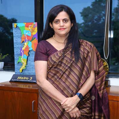
Mumbai Metro’s Line 3, which will be a 33.5-km underground route, will connect south Mumbai with the western suburbs. Recently, Maharashtra Chief Minister Eknath Shinde and Deputy Chief Minister Devendra Fadnavis flagged off the trial run for this line. However, this line has faced its own set of challenges – from acquiring land and constructing an underground line within city limits to ensuring efficient project management and more. Ashwini Bhide, Managing Director, Mumbai Metro Rail Corporation (MMRC), explains how these issues were tackled in conversation with PRATAP PADODE, Editor-in-Chief, CW.
Tell us about the metro plan for Mumbai Metro 3.
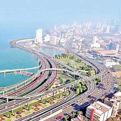
The Colaba-Bandra-SEEPZ Metro-3 corridor is unique – not only because it is underground but also in the fact that the corridor traverses 33.5-km covering all the areas that are today unconnected by railway transport, which has no provision to take additional load today. The project also travels under the heritage area. It is modern, air-conditioned, backed by latest technology, sleek, comfortable, faster and safer.
Once commissioned, it will carry 1.7 million commuters per day of which 15-20 per cent will shift from the suburban railways and the rest will shift from the road network leading to the decongestion of the roads.
This corridor will also provide connectivity to other modes of public transport such as Western and Central Railways, both the airports, Metro Lines 1, 2 and 6 – cutting across most existing and upcoming routes. The corridor has a station at Worli and Acharya Atre Chowk too which will offer more connectivity once the Worli-Sewri Connector is completed.
The station depths vary from 22 m to 30 m and at a few stations like the Airport and MIDC, the depth is 30m because of the gradient. The depth at the Airport stations is deliberately kept at 30 m to enable the Mumbai International Airport (MIAL) to commercially develop the land above these stations.
What technology did you use to understand the city’s topography?
MMRC undertook massive geotechnical investigation before the work started wherein the boreholes were taken every 250 m which normally is done every 1 km especially because the project was expected to throw a lot of challenges and full of possible unknown factors. And if we expected the contractors to be well-informed and aware of the risks. Once on board, the contractors were also expected to carry out their own geotechnical investigations in a more detailed manner.
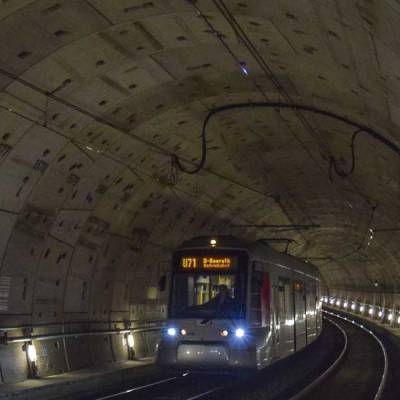
The tunnelling activity today is at an advanced stage with a lot of refinement and sophistication. The machines come with high probing capacities now.
MMRC also did a thorough survey of the condition of the existing buildings on the route. All the buildings at 50m on both sides of the entire alignment were observed, studied and existing condition was ascertained prior to tendering. Cracks, signs of distress in ceiling, problems in the foundation, and every minute detail was mapped, photographed, described and compiled for the contractors to understand what they were dealing with. The same data was shared with the building owners as well. We also carried out a detailed study to explore suitable methodology for the disposal of excavated material and prepared traffic diversion plans in advance.
The construction methodology was designed keeping in mind the possible impact on the neighbouring buildings. The serviceable limits for different impacts like vibrations, tilt and displacement were determined and three types of warning levels were set. Sophisticated instruments were installed on the buildings in the influence zone to assess the actual impact. The impact was monitored with regular intervals and if needed, there was a provision to change the design and construction methodology. Old dilapidated buildings as well as heritage buildings were given special attention with 24 x 7 monitoring.
What about buildings on the dilapidated list?
There were a few buildings that were declared dilapidated by the municipal authorities but were not demolished and engaged with occupants as well as owners. The buildings were temporarily vacated whenever needed by making alternate arrangements. Some buildings, which could have been impacted, had to be strengthened and supported. It was the contractor’s responsibility to support them with trusses and other methods. These buildings were monitored for 6 to 8 months even after the tunnelling was over.
Which construction monitoring technologies did you use?
We used different technology platforms for construction monitoring. One is the 3D building information management (BIM) system. Initially, there was some resistance because contractors would do what is done conventionally but then we conducted workshops for each package to impress upon them how important this was for the management. They engaged the right kind of people and everybody switched over.
We also extensively used Primavera, which is a project management tool. There was a digital platform through which all the contractors communicated with general consultants and also with each other. Only the documents that were specifically defined were to be submitted physically. Our consultants, AECOM, had their own digital document management system, which we adopted for this purpose. We also have an asset management platform for our digital assets so that when our operators join, we can do easy handovers.
Any challenges you would like to recount?
There were many challenges. This was a brownfield project; not a single piece of land was available to us when we started and acquiring land was one of the major challenges. Plus, the construction challenges of working in close proximity of dilapidated buildings, high rises or important infrastructure installations were a few other challenges. There are seven New Austrian Tunnelling Method (NATM) stations in this line, where we cannot cut open a full station box from the surface because there is no land available. We only have a small space; so, you cut open a small box, go in and start mining horizontally. This was extremely difficult. The Hutatma Chowk station, all three stations of Kalbadevi, Girgaon and Grant Road along with Dadar, Shitladevi and Marol were challenging to name a few more. And of course, we faced some communication and perception challenges as well that we had to alleviate.
Did you use any sustainable methods to dispose of construction waste?
The contracts mandated waste disposal in a way that is not detrimental to the environment. The sites that contractors used for disposal also had to be monitored carefully. All of this was part of our environment management plan. Some of the waste has been used as filling material in different projects and some as construction material. It was all fully owned by the contractors. It was not misused or dumped unethically.
You managed multiple aspects of this project; what was the winning strategy for you?
The most important thing was efficient project management. Employing the right workforce and right agencies for the right work and always planning ahead. We would always anticipate what could happen and prepare ourselves accordingly. For this project, we never reached a problem we could not solve. Even when we issued work orders, we had 70 per cent of the land acquired. By the time the tendering process was on, we proactively approached everything. We had a constant handholding with the contractors for better coordination and minimisation of their risks.
We also engaged constantly with all the government and non-government stakeholders in this project and also made them take ownership of the project since without their cooperation, the project would not have happened. Monitoring by the Chief Minister’s War Room as well as under PRAGATI portal by the Honourable PM himself helped us get necessary clearances. Trust and support from the MMRC Board of Directors is also an important factor which contributes to our progress so far.
We encountered many challenges along the way since the inception of the project. However, we have been able to find a solution to all of them with support from both governments and other stakeholders. Of course, Mumbaikars have also given us their support. An active social media strategy helped us to reach out to the citizens and keep them informed. My colleagues and I have used every opportunity to talk to people and apprise them on the complexity and status of the project.
How did MMRC deal with the land acquisition required for Metro 3?
“Land acquisition has always been a challenge in India. It is not a linear subject. There are many complexities involved such as the type of land, method of land titles, owners involved and different claimants. In our system, all entities connected with the land and their interests are taken into consideration for settling the claims for compensation, which is why it takes time.
The new Land Acquisition Act has brought clarity on how compensation is given and methods to calculate it. The motto is to give the right price to the owners and stakeholders. It aims to provide maximum benefit and has helped expedite processes as seen in the NHAI (National Highways Authority of India) and other projects. For Metro 3, although the total land required from private landowners was only 2.5 ha, it was divided into multiple pockets across the Kalbadevi and Girgaon area and there were owners as well as tenants – residential, commercial and institutional – to be dealt with. They all have certain rights under the Land Acquisition Act as well as under the state’s legislation, Development Control Regulations 33(7) and 33(9).
Under 33(7) there is a process for redevelopment, especially in-situ redevelopment, where tenants get slightly more than their owned areas and the owner is also compensated. We had to acquire 19-20 land parcels with more than 650 tenants and their owners. Owing to the terms of 33(7) for in-situ redevelopment, we could not shift the tenants outside, even though the Land Acquisition Act says we can relocate them elsewhere.
Of the 19 land parcels, we carved out three that were outside the influence of the metro project work and planned three towers where these people would be rehabilitated. Next, we had to take care of their temporary rehabilitation – this provision is absent in the Land Acquisition Act, so we had to borrow this practice from the ambit of 33(7). We essentially tailor-made our own land acquisition strategy for Mumbai Metro 3.
In Girgaon-Kalbadevi, we had additional challenges. These are the typical Pagdi system properties where the ownership or tenancy is not handed over conventionally, but passed on, and the land records not necessarily reflect that. To follow the Land Acquisition Act, we needed updated records. In absence of clear land titles, we went for advocate’s search reports. Then we published it in the newspapers and invited suggestions and objections. Fortunately, barring one or two cases and a few family disputes that we had to help settle, there were no objections. Also, some properties had institutional investors with trusts involved and they had their different issues.
We had to solve these problems and get approval from the competent authorities. Next, we had to shift tenants to rented premises that, incidentally, were not easily available in the vicinity. Additionally, the commercial tenants had to be shifted too. This required the drafting of yet another rent policy.
The tenement sizes varied from 100-200 sq ft to 1,200 sq ft. We divided them into groups and drafted a rent policy for each. We included provisions such as paying them in advance, including the broker charges and shifting charges.
This was a comprehensive board-approved policy. To give our people assurance against any misgivings, we went through multiple consultations, took their suggestions and reflected the reasonable demands in our policies. Now for the past three years, these people have been put in rented accommodation and the process has been resolved.
These land parcels are being developed under the DCR code 33(7) where both MHADA and BMC are involved. If these go for redevelopment, a large part of these plots would go into road widening. The remaining part is not adequate enough for a floor plate large enough to accommodate the tenant and the sale component. We informed the government that these properties were not individually developable – so we had to consider them as a singular cluster. This provision is currently unavailable in our regulations. You can only have a cluster for adjacent properties, but these 19 properties are scattered over the Girgaon-Kalbadevi area in six different locations. We had to request the government to consider them as one cluster to proceed.
We carved out three parcels not impacted by the project work with special government provision. To certify tenancies, we engaged agencies and unearthed all their records – this process went on for a year or more. MHADA also has a layered decision-making process and at every level, we handheld them to convince them and get the certifications. Yet another challenge was that these properties were of different sizes and shapes and have different entitlement as per regulations. Adjusting all these slabs within the three towers was a question. So, again, we had to sit with the tenants to agree on the standard sizes. We had to invite their views on if they were willing to pay an amount to get an increased size or lose a certain area in exchange for a price. We had to plan these in a way that the tenants get compensated and we get a sale component to recover the money we spent.
This has been a one-of-a-kind land acquisition process and it has been undertaken in an extremely short span of time.