
+
Goa starts aligning 2011 maps with survey plans
ECONOMY & POLICY

Goa starts aligning 2011 maps with survey plans

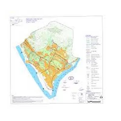
The directorate of settlement and land records (DSLR) has initiated a comparison between CZMP 2011 maps and state survey maps in order to rectify anomalies and finalize the Coastal Zone Management Plan (CZMP) for 2019.

A senior official stated that once the maps are prepared, they would be forwarded to the National Centre for Sustainable Coastal Management (NCSCM) in Chennai for corrections to be made in CZMP 2011. Following the notification of the final plans, the work on CZMP 2019 will commence. The directorate will identify features such as mangroves, sand dunes, etc., on the maps.

The discrepancies noted include village boundaries, survey plots, roads, khazan lands, and water bodies not being accurately superimposed. Additionally, the high tide line has shifted towards land.

In the meantime, the directorate, which had its plans digitized in its proprietary format, opted to convert the data into shapefiles. After completing this task, an API link was shared with the NCSCM on May 15 to ensure proper delineation of the high tide line and low tide line on the state's notified survey plans.

The Coastal Regulation Zone (CRZ) notification of 2011 mandates the notification of maps in the scale of 1:25,000. These maps were notified in November 2022. Chief Minister Pramod Sawant had mentioned, "As these maps were not legible and local-level CZMP maps are required for use by local bodies and other agencies to facilitate implementation of CZMPs, we requested the NCSCM to generate these maps in the scale of 1:4,000."

Subsequently, the NCSCM provided the maps in the scale of 1:4,000. These maps underwent scrutiny by directorate officials, revealing certain discrepancies. Efforts were made by the government to address these discrepancies through the NCSCM. However, since the maps in the scale of 1:25,000 had already been notified, the NCSCM stated that no changes could be made to these areas without the approval of the Union Environment Ministry, as the Union government had already approved the Goa CZMP on the 1:25,000 scale, including features such as the high-tide line, low-tide line, CRZ, khazans, etc.

"If the superimposition is not done in accordance with the notified survey plan of our state, which is available on the 'BhuNaksha' platform, it would result in multiple legal proceedings, and the traditional community would be adversely affected," Sawant remarked.

Moreover, without rectifying CZMP 2011, the agency responsible for preparing CZMP 2019 would be unable to finalise it, as errors would persist in the 2019 map.

The directorate of settlement and land records (DSLR) has initiated a comparison between CZMP 2011 maps and state survey maps in order to rectify anomalies and finalize the Coastal Zone Management Plan (CZMP) for 2019. A senior official stated that once the maps are prepared, they would be forwarded to the National Centre for Sustainable Coastal Management (NCSCM) in Chennai for corrections to be made in CZMP 2011. Following the notification of the final plans, the work on CZMP 2019 will commence. The directorate will identify features such as mangroves, sand dunes, etc., on the maps. The discrepancies noted include village boundaries, survey plots, roads, khazan lands, and water bodies not being accurately superimposed. Additionally, the high tide line has shifted towards land. In the meantime, the directorate, which had its plans digitized in its proprietary format, opted to convert the data into shapefiles. After completing this task, an API link was shared with the NCSCM on May 15 to ensure proper delineation of the high tide line and low tide line on the state's notified survey plans. The Coastal Regulation Zone (CRZ) notification of 2011 mandates the notification of maps in the scale of 1:25,000. These maps were notified in November 2022. Chief Minister Pramod Sawant had mentioned, As these maps were not legible and local-level CZMP maps are required for use by local bodies and other agencies to facilitate implementation of CZMPs, we requested the NCSCM to generate these maps in the scale of 1:4,000. Subsequently, the NCSCM provided the maps in the scale of 1:4,000. These maps underwent scrutiny by directorate officials, revealing certain discrepancies. Efforts were made by the government to address these discrepancies through the NCSCM. However, since the maps in the scale of 1:25,000 had already been notified, the NCSCM stated that no changes could be made to these areas without the approval of the Union Environment Ministry, as the Union government had already approved the Goa CZMP on the 1:25,000 scale, including features such as the high-tide line, low-tide line, CRZ, khazans, etc. If the superimposition is not done in accordance with the notified survey plan of our state, which is available on the 'BhuNaksha' platform, it would result in multiple legal proceedings, and the traditional community would be adversely affected, Sawant remarked. Moreover, without rectifying CZMP 2011, the agency responsible for preparing CZMP 2019 would be unable to finalise it, as errors would persist in the 2019 map.

Next Story
Infrastructure Urban

Jupiter Opens First EV Showroom in Hyderabad

Jupiter Electric Mobility Pvt Ltd (JEM), the electric commercial vehicle arm of Jupiter Wagons Ltd, has inaugurated its first showroom in New Bowenpally, Secunderabad, Hyderabad. The launch also marks the introduction of its 1.05-tonne four-wheeler electric light commercial vehicle (eLCV), JEM TEZ, to Telangana’s growing logistics and intra-city freight market. This expansion underscores JEM’s commitment to delivering purpose-built sustainable mobility solutions and accelerating the electrification of India’s logistics sector.The new showroom, operated by Arven Motors Pvt Ltd, offers cus..

Next Story
Infrastructure Energy

Premier Energies Launches 620W DCR Solar Modules in India

Premier Energies Limited, one of India’s largest integrated solar manufacturers, has launched its next-generation 620W DCR solar modules using G12R TOPCon technology, now among the most powerful large-format panels available in the country.The new modules, built with Tunnel Oxide Passivated Contact (TOPCon) architecture, deliver superior power density, improved temperature coefficients, and enhanced low-light performance. The rectangular G12R N-type cell design enables higher string power and balance-of-system optimisation, making the panels suitable for utility-scale projects as well as com..

Next Story
Infrastructure Energy

ONGC Starts Gas Sales from Rajasthan Chinnewala Tibba Block

Oil and Natural Gas Corporation Limited (ONGC) has commenced natural gas sales from the Discovered Small Field (DSF-II) Block RJ/ONDSF/Chinnewala/2018, marking the successful monetisation of the Chinnewala Tibba field in the Rajasthan Kutch Onland Exploratory Asset (RKOEA). Gas sales officially began on 25 August 2025.This development highlights ONGC’s commitment to boosting domestic energy production and strengthening India’s energy security under the guidance of the Ministry of Petroleum and Natural Gas. Located in western Rajasthan, close to the Indo-Pakistan border, the Chinnewala Tibb..

Advertisement

Subscribe to Our Newsletter

Get daily newsletters around different themes from Construction world.

STAY CONNECTED

Advertisement

Advertisement

Advertisement

Talk to us?