The Cochin Connection
ROADS & HIGHWAYS

The Cochin Connection

Dr PV Chandramohan, President-Technical, Navayuga Engineering Co, tells us how a civil engineering solution was found to a financial problem.

Cochin, or Kochi, is a port city located on the west coast of southern India. The metropolis lies at the tidal inlet of an extensive backwater system that opens out to the Arabian Sea. The water body is dotted with a number of islands. The city is spread over the Ernakulam mainland, the narrow stretches of land (Fort Kochi and Vypeen) abutting the sea, the intervening backwaters and the islands within. All this makes Kochi a confluence of land and water. On the southern side of the outlet to the sea lie the islands of Mattancherry, Palluruthy, Willingdon Island - Thevara, Nettoor and Kumbalam. The islands of Vypeen, Vallarpadom, Bolghatty and Thanthonni lie on the north.

The need for connectivity

The Central Business District is Ernakulam on the mainland. Connections from the islands to the mainland are a necessity for effective communication. But these connections require expensive bridges. The islands in the south were connected by bridges as part of external projects like Cochin Port and NH 47. But the northern islands remained unconnected as no external projects came to be located there. These islands were in a grossly underdeveloped state. The islanders depend on the mainland for their livelihood.

The only communication with the mainland is through ferries. Ferry services were few and far in between and completely absent at night. Medical emergencies resulted in tragic ends. There had been instances of heart patients dying because they could not be brought to the mainland in time. Other instances of women giving birth to babies in canoes on the way to hospital were not uncommon. Carrying cargo to the islands was easier said than done. The islanders were forced to take a hazardous boat journey, especially during monsoon, for their livelihood. The geographical integration of the parts of Kochi could be achieved only by the construction of bridges. Indeed, a bridge to the mainland had been a dream of the islanders for more than a half century. Vypeen bridges, as they were known, formed part of the election promises of all political parties. But the topic would generally die down after the polls were over.

Reclaimed land to fund bridges

It was proposed to connect Vypeen, Vallarpadom and Bolghatty islands to the Ernakulam mainland with three bridges. But the government did not have the financial resources to undertake the project. Though the islands were thickly populated, the traffic would not have justified a massive multi-bridge project. It was a reality that Vypeen bridges would not be financially viable. So funding by toll collection was ruled out. It had to be a self-supporting scheme by other means. Then, an idea was mooted to utilise land as a source for funds. This was an unprecedented way of funding a project. The proposal consisted of reclamation of 25 hectare from the waters adjacent to the mainland. It was proposed to sell this land at high prices to raise funds for the bridges.

The location of the reclamation was very crucial. In the first place, the location had to be such that it yielded high unit prices. Second, the site of reclamation had to be in shallow waters so the cost of reclamation would be low. Third, as acquisition of land for putting up approaches would be costly in a place like Kochi, the reclamation had to be so located that it also served as an approach to the bridge link. All this dictated that the reclamation of land be adjacent to the mainland. It needed to be in such a location that once completed, it would become commercially important for the city. And it also needed to serve as the launching pad for the bridges from Ernakulam. So the location of the reclamation was selected judiciously.

Details of the project

The project had four major components.
  • The first component was the reclamation of 25 hectare of land in Ernakulam mainland. This reclamation is at the heart of the city, in continuation of the Ernakulam marine drive, which is the commercial centre of Kochi. The location satisfied all the three requirements mentioned above.  
  • The second component was getting the three bridges to connect Bolghatty, Vallarpadom and Vypeen to the mainland. The first bridge takes off from the reclaimed land. The alignment then passes through the islands of Bolghatty and Vallarpadom islands and ends in Vypeen in a 3,485-m- long straight line. The crossing to Bolghatty is 370 m long and the one to Vallarpadom is 578 m while the last bridge to Vypeen is 435 m.  
  • The connecting roads between the bridges had to be built. This consists of four stretches totalling a length of 2,102 m. A major stretch is in Vallarpadom Island - 1,400 m.
  • The last part was building the road network on reclaimed land. This is not an essential component but necessary for better market value for the land to be sold.  
This multidisciplinary project involved the reclamation of land through hydraulic filling, which required pumping in bed material by dredgers. The objective of the project was to connect the Vypeen islands with the Ernakulam mainland without any fund allocation. So the essence of the project was the construction of the three bridges. Besides, it also involved road construction on the filled up land.

Land reclamation

As reclamation had to be done with soft material on soft strata, it required time for settlement. It was imperative that before the sale, the initial phase of fast settlement had to be over. Another factor was that one abutment of the first bridge would be located here. So, the first construction operation to be carried out was land reclamation. The first step was to put up the reclamation enclosure. This consisted of the construction of a rubble wall founded on a fascine mattress made of cashew twigs. Filling up soil inside the enclosure was done by using two cutter suction dredgers and floating pipelines. The entire operation of reclamation was completed in a year.

Geometrics of the bridges

The first and third bridges cross National Waterway No. 3. The second bridge crosses Cochin Port's waterway. All these bridges were profiled to be high-level bridges catering to a vertical navigational clearance of 7 m. The roadway was to climb at an easy 3 per cent gradient connected by vertical curves for a design speed of 60 km per hour. The bridges had to carry a motor carriageway, 7.5 m wide for two-lane traffic and a cycle track cum footpath, 2 m wide on either side. The bridges were designed to cater for one lane of 70® loading or two lanes of Class A loading. Because of the acute drinking water problems in the islands, a loading imposed by two water mains of 750 mm diameter was added. The location is categorised as seismic zone III and loading was carried out accordingly.

The subsoil consists of cohesive material of low shearing strength without any bearing strata. So, the pile foundations had to go deep. Six, bored cast-in-situ piles of 1,000 mm diameter were installed at each pier point. In some cases, the piles went down to a level of -68, from a cut-off level of +1.2m. The piers are in the form of twin circular columns. The superstructure consists of single box girders. The box girder had a width of 12.7 m and a span of 38.55 m. These box girders were precast near the waterfront and pre-stressed. The girders were then picked up by a specially fabricated floating hoist, floated out to the pier location and placed over the bearings. Pre-stressing was done with 12 cables, each containing 19 strands. Pre-stressing was done in two stages. The girders were supported on Pot-PTFE bearings. The bearings were, in turn, supported on pedestals and pier caps. There were two circular piers, resting on twin pile caps.

The first pile of the Vypeen bridges was pitched on August 27, 2001, and the Vypeen- Ernakulam road link was thrown open to traffic in June 2005-the fulfilment of a long-cherished dream and cause for much jubilation in the islands.

Mechanism of funding

Successive governments in Kerala somehow did not have the financial resources to fund this project despite every political party supporting it in order to woo the public. The administrative sanction was on the basis that funds for the project should be raised in a self-supporting manner. In other words, the stand of the government was that the Vypeen bridges were allowed to be funded and constructed.

The first component of reclamation was entrusted with Cochin Port Trust as deposit work. They agreed to do it, advancing funds from their own resources. The amount had to be paid with interest later. This was a great initiative. Without such a bold step, the project would have been a nonstarter. The second and third components - the three bridges and connecting roads - were clubbed together for tendering and entrusted with the Port Trust. But the Port Trust wanted the amount for this to be paid progressively as work went on.

A consortium of banks was formed for the initial funding - they had to be paid back after the sale of land. As the reclaimed land was there for everybody to see, the banks agreed to the loan. The land had to be mortgaged to the banks. One condition put forward by the banks was that the Kerala government should stand guarantee for the amount. There was a reluctant response from the government. This was perhaps owing to apprehension in the bureaucracy that the land may not fetch the required price. But eventually, after completing the tendering  
process for the land, the highest price offered came to Rs 333 crore. The amount spent on the project along with interest was about Rs 70 crore or so. So there was a saving of Rs 263 crore on an investment of Rs 70 crore!

A landmark project

The Vypeen Bridges Project, popularly known as the Goshree Project, has no parallels in history. Despite the government's lack of will, the faith of the banks in the self-supporting capability of the project made it possible. This was a true financial challenge, but it was met handsomely by a brilliant piece of civil engineering. Indeed, this was a civil engineering solution to a financial problem.

To share your views on the above article, write in at feedback@ASAPPmedia.com
Dr PV Chandramohan, President-Technical, Navayuga Engineering Co, tells us how a civil engineering solution was found to a financial problem.Cochin, or Kochi, is a port city located on the west coast of southern India. The metropolis lies at the tidal inlet of an extensive backwater system that opens out to the Arabian Sea. The water body is dotted with a number of islands. The city is spread over the Ernakulam mainland, the narrow stretches of land (Fort Kochi and Vypeen) abutting the sea, the intervening backwaters and the islands within. All this makes Kochi a confluence of land and water. On the southern side of the outlet to the sea lie the islands of Mattancherry, Palluruthy, Willingdon Island - Thevara, Nettoor and Kumbalam. The islands of Vypeen, Vallarpadom, Bolghatty and Thanthonni lie on the north.The need for connectivityThe Central Business District is Ernakulam on the mainland. Connections from the islands to the mainland are a necessity for effective communication. But these connections require expensive bridges. The islands in the south were connected by bridges as part of external projects like Cochin Port and NH 47. But the northern islands remained unconnected as no external projects came to be located there. These islands were in a grossly underdeveloped state. The islanders depend on the mainland for their livelihood.The only communication with the mainland is through ferries. Ferry services were few and far in between and completely absent at night. Medical emergencies resulted in tragic ends. There had been instances of heart patients dying because they could not be brought to the mainland in time. Other instances of women giving birth to babies in canoes on the way to hospital were not uncommon. Carrying cargo to the islands was easier said than done. The islanders were forced to take a hazardous boat journey, especially during monsoon, for their livelihood. The geographical integration of the parts of Kochi could be achieved only by the construction of bridges. Indeed, a bridge to the mainland had been a dream of the islanders for more than a half century. Vypeen bridges, as they were known, formed part of the election promises of all political parties. But the topic would generally die down after the polls were over.Reclaimed land to fund bridgesIt was proposed to connect Vypeen, Vallarpadom and Bolghatty islands to the Ernakulam mainland with three bridges. But the government did not have the financial resources to undertake the project. Though the islands were thickly populated, the traffic would not have justified a massive multi-bridge project. It was a reality that Vypeen bridges would not be financially viable. So funding by toll collection was ruled out. It had to be a self-supporting scheme by other means. Then, an idea was mooted to utilise land as a source for funds. This was an unprecedented way of funding a project. The proposal consisted of reclamation of 25 hectare from the waters adjacent to the mainland. It was proposed to sell this land at high prices to raise funds for the bridges.The location of the reclamation was very crucial. In the first place, the location had to be such that it yielded high unit prices. Second, the site of reclamation had to be in shallow waters so the cost of reclamation would be low. Third, as acquisition of land for putting up approaches would be costly in a place like Kochi, the reclamation had to be so located that it also served as an approach to the bridge link. All this dictated that the reclamation of land be adjacent to the mainland. It needed to be in such a location that once completed, it would become commercially important for the city. And it also needed to serve as the launching pad for the bridges from Ernakulam. So the location of the reclamation was selected judiciously.Details of the projectThe project had four major components.The first component was the reclamation of 25 hectare of land in Ernakulam mainland. This reclamation is at the heart of the city, in continuation of the Ernakulam marine drive, which is the commercial centre of Kochi. The location satisfied all the three requirements mentioned above.  The second component was getting the three bridges to connect Bolghatty, Vallarpadom and Vypeen to the mainland. The first bridge takes off from the reclaimed land. The alignment then passes through the islands of Bolghatty and Vallarpadom islands and ends in Vypeen in a 3,485-m- long straight line. The crossing to Bolghatty is 370 m long and the one to Vallarpadom is 578 m while the last bridge to Vypeen is 435 m.  The connecting roads between the bridges had to be built. This consists of four stretches totalling a length of 2,102 m. A major stretch is in Vallarpadom Island - 1,400 m.The last part was building the road network on reclaimed land. This is not an essential component but necessary for better market value for the land to be sold.  This multidisciplinary project involved the reclamation of land through hydraulic filling, which required pumping in bed material by dredgers. The objective of the project was to connect the Vypeen islands with the Ernakulam mainland without any fund allocation. So the essence of the project was the construction of the three bridges. Besides, it also involved road construction on the filled up land.Land reclamationAs reclamation had to be done with soft material on soft strata, it required time for settlement. It was imperative that before the sale, the initial phase of fast settlement had to be over. Another factor was that one abutment of the first bridge would be located here. So, the first construction operation to be carried out was land reclamation. The first step was to put up the reclamation enclosure. This consisted of the construction of a rubble wall founded on a fascine mattress made of cashew twigs. Filling up soil inside the enclosure was done by using two cutter suction dredgers and floating pipelines. The entire operation of reclamation was completed in a year.Geometrics of the bridgesThe first and third bridges cross National Waterway No. 3. The second bridge crosses Cochin Port's waterway. All these bridges were profiled to be high-level bridges catering to a vertical navigational clearance of 7 m. The roadway was to climb at an easy 3 per cent gradient connected by vertical curves for a design speed of 60 km per hour. The bridges had to carry a motor carriageway, 7.5 m wide for two-lane traffic and a cycle track cum footpath, 2 m wide on either side. The bridges were designed to cater for one lane of 70® loading or two lanes of Class A loading. Because of the acute drinking water problems in the islands, a loading imposed by two water mains of 750 mm diameter was added. The location is categorised as seismic zone III and loading was carried out accordingly.The subsoil consists of cohesive material of low shearing strength without any bearing strata. So, the pile foundations had to go deep. Six, bored cast-in-situ piles of 1,000 mm diameter were installed at each pier point. In some cases, the piles went down to a level of -68, from a cut-off level of +1.2m. The piers are in the form of twin circular columns. The superstructure consists of single box girders. The box girder had a width of 12.7 m and a span of 38.55 m. These box girders were precast near the waterfront and pre-stressed. The girders were then picked up by a specially fabricated floating hoist, floated out to the pier location and placed over the bearings. Pre-stressing was done with 12 cables, each containing 19 strands. Pre-stressing was done in two stages. The girders were supported on Pot-PTFE bearings. The bearings were, in turn, supported on pedestals and pier caps. There were two circular piers, resting on twin pile caps.The first pile of the Vypeen bridges was pitched on August 27, 2001, and the Vypeen- Ernakulam road link was thrown open to traffic in June 2005-the fulfilment of a long-cherished dream and cause for much jubilation in the islands.Mechanism of fundingSuccessive governments in Kerala somehow did not have the financial resources to fund this project despite every political party supporting it in order to woo the public. The administrative sanction was on the basis that funds for the project should be raised in a self-supporting manner. In other words, the stand of the government was that the Vypeen bridges were allowed to be funded and constructed.The first component of reclamation was entrusted with Cochin Port Trust as deposit work. They agreed to do it, advancing funds from their own resources. The amount had to be paid with interest later. This was a great initiative. Without such a bold step, the project would have been a nonstarter. The second and third components - the three bridges and connecting roads - were clubbed together for tendering and entrusted with the Port Trust. But the Port Trust wanted the amount for this to be paid progressively as work went on.A consortium of banks was formed for the initial funding - they had to be paid back after the sale of land. As the reclaimed land was there for everybody to see, the banks agreed to the loan. The land had to be mortgaged to the banks. One condition put forward by the banks was that the Kerala government should stand guarantee for the amount. There was a reluctant response from the government. This was perhaps owing to apprehension in the bureaucracy that the land may not fetch the required price. But eventually, after completing the tendering  process for the land, the highest price offered came to Rs 333 crore. The amount spent on the project along with interest was about Rs 70 crore or so. So there was a saving of Rs 263 crore on an investment of Rs 70 crore!A landmark projectThe Vypeen Bridges Project, popularly known as the Goshree Project, has no parallels in history. Despite the government's lack of will, the faith of the banks in the self-supporting capability of the project made it possible. This was a true financial challenge, but it was met handsomely by a brilliant piece of civil engineering. Indeed, this was a civil engineering solution to a financial problem.To share your views on the above article, write in at feedback@ASAPPmedia.com
Next Story
Real Estate

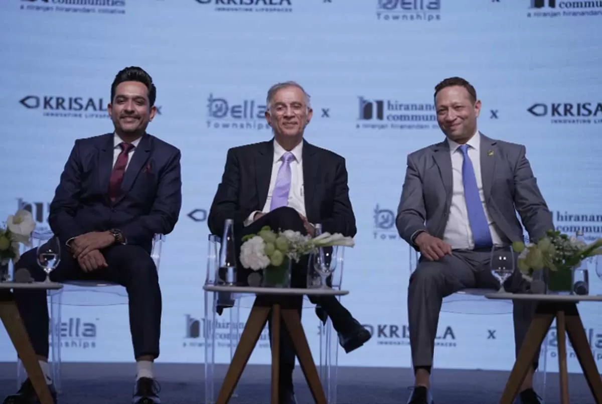
Della, Hiranandani & Krisala unveil Rs 11 billion themed township in Pune

In a first-of-its-kind initiative, Della Resorts & Adventure has partnered with Hiranandani Communities and Krisala Developers to develop a Rs 11 billion racecourse-themed township in North Hinjewadi, Pune. Based on Della’s proprietary CDDMO™ model, the hospitality-led, design-driven project aims to deliver up to 9 per cent returns—significantly higher than the typical 3 per cent in residential real estate.Spanning 40 acres within a 105-acre master plan, the mega township will feature an 8-acre racecourse and international polo club, 128 private villa plots, 112 resort residences, a ..

Next Story
Real Estate

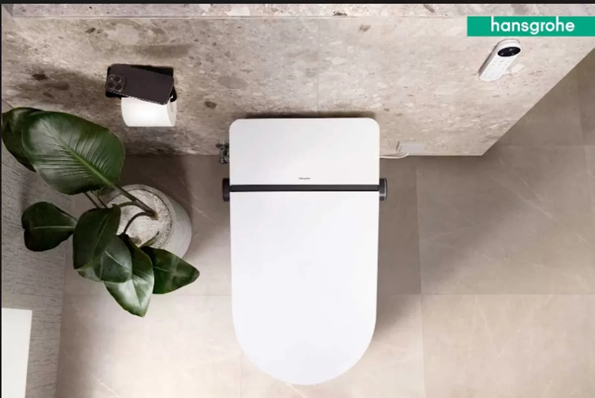
Hansgrohe unveils LavaPura Element S e-toilets in India

Hansgrohe India has launched its latest innovation, the LavaPura Element S e-toilet series, introducing a new standard in hygiene-focused, smart bathroom solutions tailored for Indian homes and high-end hospitality spaces.Blending German engineering with minimalist aesthetics, the LavaPura Element S combines intuitive features with advanced hygiene technology. The series is designed for easy installation and optimal performance under Indian conditions, reinforcing the brand’s focus on functional elegance and modern convenience.“With evolving consumer preferences, smart bathrooms are no lon..

Next Story
Infrastructure Urban

HCC Net Profit Stands at Rs 2.28 Billion for Q4 FY25

Hindustan Construction Company (HCC) reported a standalone net profit of Rs 2.28 billion in Q4 FY25, a sharp increase from Rs 388 million in Q4 FY24. Standalone revenue for the quarter stood at Rs 13.30 billion, compared to Rs 14.28 billion in Q4 FY24. For the full fiscal year, the company reported a standalone net profit of Rs 849 million, down from Rs 1.79 billion in FY24. Standalone revenue for FY25 was Rs 48.01 billion, compared to Rs 50.43 billion in the previous year.Consolidated revenue for Q4 FY25 stood at Rs 13.74 billion, and for FY25 at Rs 56.03 billion, down from Rs 17.73 billion i..

Advertisement

Advertisement

Subscribe to Our Newsletter

Get daily newsletters around different themes from Construction world.

STAY CONNECTED

Advertisement

Advertisement

Advertisement

Advertisement

Talk to us?