Assam govt to map 700 villages via drone technology
Real Estate

Assam govt to map 700 villages via drone technology

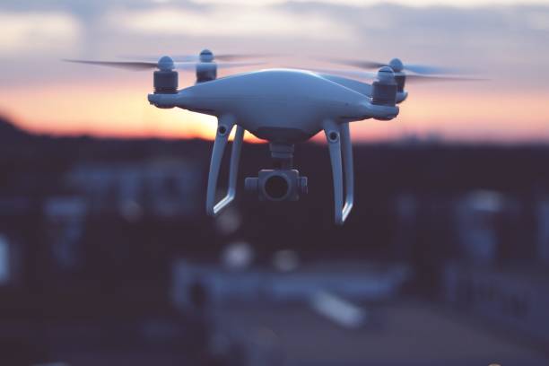
The Assam government will map 700 villages using drones, which could help in the future to demarcate the borders with other states in the area.

The government said that there are nearly 22,724 villages in Assam, out of which 700 have no maps, so it poses trouble for the government for land projects, including the buying and selling lands.

The project under the Survey of India started at Singimari village under the Hajo revenue circle in Kamrup district. After the adjoining states settle the dispute with Assam, drones will demarcate the borders of the Assam villages.

The Principal of the Assam Survey and Settlement Training Centre, Pankaj Chakravarty, said after completing the pilot project, the mapping would begin in Dibrugarh and Tinsukia districts. Without mapping, the boundaries are incomplete.

The Survey of India had given the drones for the exercise, and the remaining work will be taken over by the Kamrup administration and the Assam Survey. The No.1 Singimari is 2.98 sq km, but the survey will take a month to complete.

Mapping of the villages was prepared in the state using the conventional model, but many remained unmapped in the village areas. According to the sources, the survey pillars are missing in many inter-district, inter-state and international borders in Assam. The plan is to demarcate the borders in future with a drone survey.

District Commissioner of Kamrup, Kailash Karthik N, told the media that Singimari is the first village under Mission Vasundhara to be mapped. Kamrup and a conflict with the Meghalaya border. After the agreement between the two states, the demarcation will be done via drone.

Image Source


  Also read: Government to purchase 200 drones to speed up land mapping process

The Assam government will map 700 villages using drones, which could help in the future to demarcate the borders with other states in the area. The government said that there are nearly 22,724 villages in Assam, out of which 700 have no maps, so it poses trouble for the government for land projects, including the buying and selling lands. The project under the Survey of India started at Singimari village under the Hajo revenue circle in Kamrup district. After the adjoining states settle the dispute with Assam, drones will demarcate the borders of the Assam villages. The Principal of the Assam Survey and Settlement Training Centre, Pankaj Chakravarty, said after completing the pilot project, the mapping would begin in Dibrugarh and Tinsukia districts. Without mapping, the boundaries are incomplete. The Survey of India had given the drones for the exercise, and the remaining work will be taken over by the Kamrup administration and the Assam Survey. The No.1 Singimari is 2.98 sq km, but the survey will take a month to complete. Mapping of the villages was prepared in the state using the conventional model, but many remained unmapped in the village areas. According to the sources, the survey pillars are missing in many inter-district, inter-state and international borders in Assam. The plan is to demarcate the borders in future with a drone survey. District Commissioner of Kamrup, Kailash Karthik N, told the media that Singimari is the first village under Mission Vasundhara to be mapped. Kamrup and a conflict with the Meghalaya border. After the agreement between the two states, the demarcation will be done via drone. Image Source  Also read: Government to purchase 200 drones to speed up land mapping process

Next Story
Resources

Skyview by Empyrean is Making Benchmarks in the Indian Ropeway Industry

FIL Industries Private Limited, the parent company of Empyrean Skyview Projects that pioneered ropeway mobility solutions in India with Jammu’s Skyview Gondola, is currently developing the Dehradun-Mussoorie ropeway and is on track to complete Phase I by September 2026. The ropeway is set to be India’s longest passenger aerial monocable covering 5.8 km between the foothills of Dehradun in Purkulgam and MDDA taxi stand in the hills of Mussoorie in just under 20 minutes. The firm pioneered green mobility solutions in India with the development of the flagship Skyview Gondola in Jam..

Next Story
Technology

Creativity is for Humans, Productivity is for Robots!

On most construction sites, the rhythm of progress is measured by the clang of steel, the hum of machinery and the sweat of thousands. But increasingly, new sounds are entering the mix: the quiet efficiency of algorithms, the hum of drones overhead, and the precision of robotic arms at work. Behind the concrete and cables, an invisible force is taking hold: data. It is turning blueprints into living simulations, managing fleets of machines, and helping engineers make decisions before a single brick is laid. This is not the construction of tomorrow; it is the architecture of today – built on ..

Next Story
Infrastructure Urban

Bhartiya Urban Unveils ‘Bhartiya Converge’ GCC Enablement Platform

Bhartiya Urban has launched Bhartiya Converge, its latest business venture designed to become India’s premier platform for enabling Global Capability Centres (GCCs). The initiative offers an integrated ecosystem aimed at helping global clients gain a competitive edge in today’s rapidly evolving business environment. Focused on enhancing turnaround time and operational efficiencies, the company seeks to deliver better business outcomes powered by top-tier talent. Bhartiya Converge presents a customised and integrated suite of microservices that addresses the nuanced and evolving operational..

Advertisement

Advertisement

Subscribe to Our Newsletter

Get daily newsletters around different themes from Construction world.

STAY CONNECTED

Advertisement

Advertisement

Advertisement

Advertisement

Talk to us?