Bengaluru Metro Line Plan With Five Kilometre Stadium Link Ready
RAILWAYS & METRO RAIL

Bengaluru Metro Line Plan With Five Kilometre Stadium Link Ready

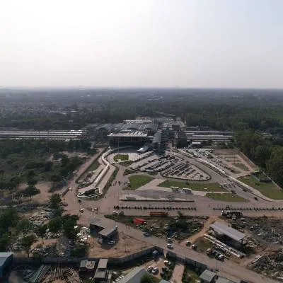
The plan for Bengaluru's longest metro line is ready and proposes a route that totals 73 km, including a five kilometre (km) spur to the new stadium. The alignment would make this corridor the longest in the Bengaluru Metro network and is presented as a single integrated line with a dedicated stadium link. Planners designed the alignment to improve orbital and radial connectivity across southern and eastern corridors, connecting residential and commercial districts. The proposal notes interfaces with existing lines to allow seamless transfers.

The proposal lays out station spacing, interchange points and depot access while retaining flexibility for engineering and land acquisition constraints. It includes the stadium spur as an integrated element rather than a later addition and indicates where elevated and underground sections are preferable. Project documents describe considerations for passenger interchange and last mile connectivity. Environmental and traffic impact assessments are referenced to guide alignment choices.

The corridor is intended to serve both commuter and event traffic and to distribute ridership across the wider network, reducing pressure on congested segments, particularly during peak hours and major events. Technical teams have prepared alignment maps, preliminary cost estimates and utility relocation plans as part of the planning package. The scheme also accounts for multimodal integration with bus and suburban rail services. Capacity planning considers peak event flows as well as daily commuter demand.

Next steps set out in the planning package include detailed design, statutory clearances and funding arrangements before procurement and construction. Authorities will need to coordinate with municipal agencies and the stadium authority to finalise station locations on the spur. Public consultations will inform station design and access arrangements. The readiness of the plan is offered as a basis for formal approvals and subsequent delivery phases over several years.

"Join industry leaders at RAHSTA Expo, India's premier platform for roads, highways and traffic infrastructure. Register now to explore innovations, network with experts and shape the future of mobility."

The plan for Bengaluru's longest metro line is ready and proposes a route that totals 73 km, including a five kilometre (km) spur to the new stadium. The alignment would make this corridor the longest in the Bengaluru Metro network and is presented as a single integrated line with a dedicated stadium link. Planners designed the alignment to improve orbital and radial connectivity across southern and eastern corridors, connecting residential and commercial districts. The proposal notes interfaces with existing lines to allow seamless transfers. The proposal lays out station spacing, interchange points and depot access while retaining flexibility for engineering and land acquisition constraints. It includes the stadium spur as an integrated element rather than a later addition and indicates where elevated and underground sections are preferable. Project documents describe considerations for passenger interchange and last mile connectivity. Environmental and traffic impact assessments are referenced to guide alignment choices. The corridor is intended to serve both commuter and event traffic and to distribute ridership across the wider network, reducing pressure on congested segments, particularly during peak hours and major events. Technical teams have prepared alignment maps, preliminary cost estimates and utility relocation plans as part of the planning package. The scheme also accounts for multimodal integration with bus and suburban rail services. Capacity planning considers peak event flows as well as daily commuter demand. Next steps set out in the planning package include detailed design, statutory clearances and funding arrangements before procurement and construction. Authorities will need to coordinate with municipal agencies and the stadium authority to finalise station locations on the spur. Public consultations will inform station design and access arrangements. The readiness of the plan is offered as a basis for formal approvals and subsequent delivery phases over several years.

Next Story
Infrastructure Transport

Uttar Pradesh unveils infrastructure-led growth roadmap at RAHSTA

Mumbai, 9 July 2026: Uttar Pradesh’s ambitious infrastructure-led growth strategy took centre stage on Day 2 of the 16th RAHSTA Expo, where senior government officials outlined how expressways, industrial corridors and technology-driven governance are transforming the state into one of India's most attractive investment destinations.Delivering the keynote address, Srihari Pratap Shahi, IAS, Additional Chief Executive Officer, Uttar Pradesh Expressways Industrial Development Authority (UPEIDA), highlighted the state's long-term vision of integrating world-class expressways with industrial dev..

Next Story
Real Estate

NCW closes PRIME Offices Fund at Rs 40 billion

Nuvama and Cushman & Wakefield Management (NCW) has announced the final close of its flagship PRIME Offices Fund at approximately Rs 40 billion, exceeding its original target of Rs 30 billion following strong investor demand.The fund was launched to provide Indian investors with access to institutional-grade commercial office assets across key office markets in the country. According to NCW, the increase in the fund size was supported by strong investor participation and the availability of investment opportunities in India's office sector.The fund has already committed around 45 per cent ..

Next Story
Real Estate

Mayfair Housing adopts Autodesk Forma for digital project planning

Mayfair Housing has entered into a three-year strategic partnership with Autodesk to deploy Autodesk Forma, an AI-enabled cloud platform, as part of its digital transformation programme aimed at improving project planning and execution across its development and redevelopment portfolio.The platform will be integrated into the company's Building Information Modelling (BIM) workflow to support architects, planners and project teams during the early stages of design and development. Autodesk Forma combines real-world data, environmental simulations and collaborative workflows to facilitate data-d..

Advertisement

Subscribe to Our Newsletter

Get daily newsletters around different themes from Construction world.

STAY CONNECTED

Advertisement

Advertisement

Advertisement