


Goa compares maps for coastal plan
ECONOMY & POLICY

Goa compares maps for coastal plan

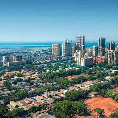
Goa has initiated a significant step towards finalizing its coastal plan by comparing 2011 maps with recent survey plans. This move aims to ensure sustainable development along its picturesque coastline. The coastal plan holds immense importance for balancing conservation efforts with developmental needs, particularly in a state renowned for its pristine beaches and biodiversity. By meticulously examining the data from 2011 alongside current survey plans, authorities seek to identify changes and update regulations accordingly.

The comparison process involves evaluating alterations in land use patterns, infrastructure development, and natural features along the coastline. Such a thorough review enables policymakers to make informed decisions regarding future development projects, ensuring they align with environmental sustainability goals and mitigate potential risks to fragile ecosystems.

Goa's coastal areas are not only vital for tourism but also support diverse marine life and serve as a buffer against natural disasters like storms and erosion. Therefore, any revisions to the coastal plan must strike a delicate balance between facilitating responsible development and preserving the state's natural heritage.

By leveraging technology and expertise, officials aim to create a comprehensive and dynamic coastal plan that addresses the evolving needs of Goa's coastal communities while safeguarding its environmental treasures. Stakeholder engagement and public consultation will also play a crucial role in shaping the final plan, fostering transparency and inclusivity in the decision-making process.

The comparison of maps marks a crucial milestone in Goa's efforts to update its coastal management strategies and adapt to changing socio-economic and environmental dynamics. As the state progresses towards finalizing its coastal plan, stakeholders and residents alike anticipate a balanced approach that ensures sustainable development without compromising Goa's natural charm and ecological integrity.

"Join industry leaders at RAHSTA Expo, India's premier platform for roads, highways and traffic infrastructure. Register now to explore innovations, network with experts and shape the future of mobility."

Goa has initiated a significant step towards finalizing its coastal plan by comparing 2011 maps with recent survey plans. This move aims to ensure sustainable development along its picturesque coastline. The coastal plan holds immense importance for balancing conservation efforts with developmental needs, particularly in a state renowned for its pristine beaches and biodiversity. By meticulously examining the data from 2011 alongside current survey plans, authorities seek to identify changes and update regulations accordingly. The comparison process involves evaluating alterations in land use patterns, infrastructure development, and natural features along the coastline. Such a thorough review enables policymakers to make informed decisions regarding future development projects, ensuring they align with environmental sustainability goals and mitigate potential risks to fragile ecosystems. Goa's coastal areas are not only vital for tourism but also support diverse marine life and serve as a buffer against natural disasters like storms and erosion. Therefore, any revisions to the coastal plan must strike a delicate balance between facilitating responsible development and preserving the state's natural heritage. By leveraging technology and expertise, officials aim to create a comprehensive and dynamic coastal plan that addresses the evolving needs of Goa's coastal communities while safeguarding its environmental treasures. Stakeholder engagement and public consultation will also play a crucial role in shaping the final plan, fostering transparency and inclusivity in the decision-making process. The comparison of maps marks a crucial milestone in Goa's efforts to update its coastal management strategies and adapt to changing socio-economic and environmental dynamics. As the state progresses towards finalizing its coastal plan, stakeholders and residents alike anticipate a balanced approach that ensures sustainable development without compromising Goa's natural charm and ecological integrity.

Next Story
Infrastructure Transport

Uttar Pradesh unveils infrastructure-led growth roadmap at RAHSTA

Mumbai, 9 July 2026: Uttar Pradesh’s ambitious infrastructure-led growth strategy took centre stage on Day 2 of the 16th RAHSTA Expo, where senior government officials outlined how expressways, industrial corridors and technology-driven governance are transforming the state into one of India's most attractive investment destinations.Delivering the keynote address, Srihari Pratap Shahi, IAS, Additional Chief Executive Officer, Uttar Pradesh Expressways Industrial Development Authority (UPEIDA), highlighted the state's long-term vision of integrating world-class expressways with industrial dev..

Next Story
Real Estate

NCW closes PRIME Offices Fund at Rs 40 billion

Nuvama and Cushman & Wakefield Management (NCW) has announced the final close of its flagship PRIME Offices Fund at approximately Rs 40 billion, exceeding its original target of Rs 30 billion following strong investor demand.The fund was launched to provide Indian investors with access to institutional-grade commercial office assets across key office markets in the country. According to NCW, the increase in the fund size was supported by strong investor participation and the availability of investment opportunities in India's office sector.The fund has already committed around 45 per cent ..

Next Story
Real Estate

Mayfair Housing adopts Autodesk Forma for digital project planning

Mayfair Housing has entered into a three-year strategic partnership with Autodesk to deploy Autodesk Forma, an AI-enabled cloud platform, as part of its digital transformation programme aimed at improving project planning and execution across its development and redevelopment portfolio.The platform will be integrated into the company's Building Information Modelling (BIM) workflow to support architects, planners and project teams during the early stages of design and development. Autodesk Forma combines real-world data, environmental simulations and collaborative workflows to facilitate data-d..

Advertisement

Subscribe to Our Newsletter

Get daily newsletters around different themes from Construction world.

STAY CONNECTED

Advertisement

Advertisement

Advertisement