Mangaluru to Conduct 3D Digital Twin Drone Survey
ECONOMY & POLICY

Mangaluru to Conduct 3D Digital Twin Drone Survey

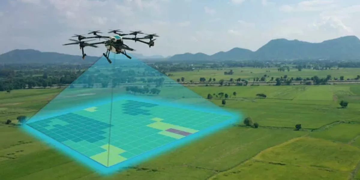
The Mangaluru City Corporation has announced plans to conduct a 3D digital twin drone survey aimed at enhancing urban planning and development initiatives. This innovative survey method involves using drones equipped with advanced technology to create detailed three-dimensional models and maps of the city's infrastructure, buildings, and topography.

The primary objective of the 3D digital twin survey is to improve the accuracy and efficiency of urban planning processes in Mangaluru. By leveraging drone technology, the civic body aims to gather precise data on spatial dimensions, geographical features, and structural conditions of various areas within the city limits.

The digital twin models generated from the survey will serve as virtual replicas of Mangaluru's physical environment, facilitating better decision-making in infrastructure development, disaster management, and environmental conservation efforts. This technology-driven approach is expected to streamline urban governance and optimise resource allocation for sustainable development.

The initiative underscores Mangaluru City Corporation's commitment to embracing technological innovations to address urban challenges and enhance the quality of life for its residents. By harnessing the power of 3D digital twin technology, the civic body aims to foster smart growth and resilience in urban infrastructure planning and management.

The upcoming drone survey represents a significant step towards modernising urban planning practices in Mangaluru, aligning with global trends in smart city development and digital transformation initiatives. It is poised to set a benchmark for leveraging drone technology for comprehensive city mapping and infrastructure management in India.

The Mangaluru City Corporation has announced plans to conduct a 3D digital twin drone survey aimed at enhancing urban planning and development initiatives. This innovative survey method involves using drones equipped with advanced technology to create detailed three-dimensional models and maps of the city's infrastructure, buildings, and topography. The primary objective of the 3D digital twin survey is to improve the accuracy and efficiency of urban planning processes in Mangaluru. By leveraging drone technology, the civic body aims to gather precise data on spatial dimensions, geographical features, and structural conditions of various areas within the city limits. The digital twin models generated from the survey will serve as virtual replicas of Mangaluru's physical environment, facilitating better decision-making in infrastructure development, disaster management, and environmental conservation efforts. This technology-driven approach is expected to streamline urban governance and optimise resource allocation for sustainable development. The initiative underscores Mangaluru City Corporation's commitment to embracing technological innovations to address urban challenges and enhance the quality of life for its residents. By harnessing the power of 3D digital twin technology, the civic body aims to foster smart growth and resilience in urban infrastructure planning and management. The upcoming drone survey represents a significant step towards modernising urban planning practices in Mangaluru, aligning with global trends in smart city development and digital transformation initiatives. It is poised to set a benchmark for leveraging drone technology for comprehensive city mapping and infrastructure management in India.

Next Story
Resources

Skyview by Empyrean is Making Benchmarks in the Indian Ropeway Industry

FIL Industries Private Limited, the parent company of Empyrean Skyview Projects that pioneered ropeway mobility solutions in India with Jammu’s Skyview Gondola, is currently developing the Dehradun-Mussoorie ropeway and is on track to complete Phase I by September 2026. The ropeway is set to be India’s longest passenger aerial monocable covering 5.8 km between the foothills of Dehradun in Purkulgam and MDDA taxi stand in the hills of Mussoorie in just under 20 minutes. The firm pioneered green mobility solutions in India with the development of the flagship Skyview Gondola in Jam..

Next Story
Technology

Creativity is for Humans, Productivity is for Robots!

On most construction sites, the rhythm of progress is measured by the clang of steel, the hum of machinery and the sweat of thousands. But increasingly, new sounds are entering the mix: the quiet efficiency of algorithms, the hum of drones overhead, and the precision of robotic arms at work. Behind the concrete and cables, an invisible force is taking hold: data. It is turning blueprints into living simulations, managing fleets of machines, and helping engineers make decisions before a single brick is laid. This is not the construction of tomorrow; it is the architecture of today – built on ..

Next Story
Infrastructure Urban

Bhartiya Urban Unveils ‘Bhartiya Converge’ GCC Enablement Platform

Bhartiya Urban has launched Bhartiya Converge, its latest business venture designed to become India’s premier platform for enabling Global Capability Centres (GCCs). The initiative offers an integrated ecosystem aimed at helping global clients gain a competitive edge in today’s rapidly evolving business environment. Focused on enhancing turnaround time and operational efficiencies, the company seeks to deliver better business outcomes powered by top-tier talent. Bhartiya Converge presents a customised and integrated suite of microservices that addresses the nuanced and evolving operational..

Advertisement

Advertisement

Subscribe to Our Newsletter

Get daily newsletters around different themes from Construction world.

STAY CONNECTED

Advertisement

Advertisement

Advertisement

Advertisement

Talk to us?