Laser-enabled aerial LiDAR for Delhi-Varanasi hi-speed corridor
Technology

Laser-enabled aerial LiDAR for Delhi-Varanasi hi-speed corridor

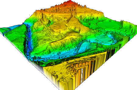
National High Speed Rail Corporation Limited (NHSRCL) will be adopting Light Detection and Ranging Survey (LiDAR) technique using laser enabled equipment mounted on a helicopter for conducting ground survey for the preparation of Detailed Project Report (DPR) for the proposed Delhi-Varanasi HSR corridor (DVHSR).

Keeping in mind the magnitude of the project and adhering to the timelines to submit the DPR of DVHSR corridor, the ground survey using aerial LiDAR technique has already started. Reference points on the ground have already been marked and data collection through equipment mounted on a helicopter will commence from December 13 (depending on the weather conditions) in a phased manner. The requisite permissions from the Ministry of Defence for flying the helicopter have been received and the inspection of the aircraft and equipment are underway.

The aerial LiDAR survey technique is expected to save time exponentially. The first instance of the aerial technique for a railway project in India was adopted for the Mumbai- Ahmedabad High Speed Rail Corridor, chosen primarily because of its high accuracy. The ground survey using aerial LiDAR for MAHSR alignment was done only in 12 weeks against the 10-12 months if had been done through traditional survey methods.

The proposed Delhi-Varanasi HSR alignment covers mixed terrains including densely populated urban and rural areas, highways, roads, ghats, rivers, green fields etc. which makes this activity more challenging. The tentative length of the corridor is about 800 km. The alignment and stations will be decided in consultation with the government.

The alignment or ground survey is a crucial activity for any linear infrastructure project as the survey provides accurate details of areas around the alignment. This technique uses a combination of laser data, GPS data, flight parameters and actual photographs to give accurate survey data. Based on the findings of the survey, designing of the vertical and horizontal alignment, structures, location of the stations and depots, land requirement for the corridor, identification of project affected plots or structures, right-of-way, and so on, are decided.

NHSRCL has been entrusted by the Ministry of Railways with preparing the Detailed Project Report (DPR) for the Delhi-Varanasi high-speed corridor.

Source: Press Information Bureau (Government of India)

Also read: Bids invited for Delhi-Amritsar high-speed rail corridor

Image credit: Base Camp Aviation

Your next big infra connection is waiting at RAHSTA 2025 – Asia’s Biggest Roads & Highways Expo, Jio World Convention Centre, Mumbai. Don’t miss out!

National High Speed Rail Corporation Limited (NHSRCL) will be adopting Light Detection and Ranging Survey (LiDAR) technique using laser enabled equipment mounted on a helicopter for conducting ground survey for the preparation of Detailed Project Report (DPR) for the proposed Delhi-Varanasi HSR corridor (DVHSR). Keeping in mind the magnitude of the project and adhering to the timelines to submit the DPR of DVHSR corridor, the ground survey using aerial LiDAR technique has already started. Reference points on the ground have already been marked and data collection through equipment mounted on a helicopter will commence from December 13 (depending on the weather conditions) in a phased manner. The requisite permissions from the Ministry of Defence for flying the helicopter have been received and the inspection of the aircraft and equipment are underway. The aerial LiDAR survey technique is expected to save time exponentially. The first instance of the aerial technique for a railway project in India was adopted for the Mumbai- Ahmedabad High Speed Rail Corridor, chosen primarily because of its high accuracy. The ground survey using aerial LiDAR for MAHSR alignment was done only in 12 weeks against the 10-12 months if had been done through traditional survey methods. The proposed Delhi-Varanasi HSR alignment covers mixed terrains including densely populated urban and rural areas, highways, roads, ghats, rivers, green fields etc. which makes this activity more challenging. The tentative length of the corridor is about 800 km. The alignment and stations will be decided in consultation with the government. The alignment or ground survey is a crucial activity for any linear infrastructure project as the survey provides accurate details of areas around the alignment. This technique uses a combination of laser data, GPS data, flight parameters and actual photographs to give accurate survey data. Based on the findings of the survey, designing of the vertical and horizontal alignment, structures, location of the stations and depots, land requirement for the corridor, identification of project affected plots or structures, right-of-way, and so on, are decided. NHSRCL has been entrusted by the Ministry of Railways with preparing the Detailed Project Report (DPR) for the Delhi-Varanasi high-speed corridor. Source: Press Information Bureau (Government of India) Also read: Bids invited for Delhi-Amritsar high-speed rail corridor Image credit: Base Camp Aviation

Next Story
Infrastructure Transport

Indian Railways Marks New Milestone with 4.5 km Long ‘Rudrastra’ Trial

Indian Railways has successfully conducted the trial run of Asia’s longest freight train, named ‘Rudrastra’, achieving a new milestone in cargo transportation, as per news reports. The 4.5 km-long train began its trial from Ganjkhwaja railway station in Chandauli, Uttar Pradesh, and travelled to Garhwa in Jharkhand. Covering a distance of 209 km in 5 hours and 10 minutes, it maintained an average speed of 40.5 km per hour. The train was formed by combining three long-haul racks, with ..

Next Story
Infrastructure Energy

UltraTech Launches India’s First On-Site Hybrid RTC Renewable Energy Project

UltraTech Cement has operationalised a 7.5 MW round-the-clock (RTC) hybrid renewable energy project at its Sewagram Cement Works in Gujarat. The first-of-its-kind solution combines bifacial solar modules with trackers, wind energy and battery storage, co-located on-site, to ensure uninterrupted power for cement manufacturing without grid reliance. The project was executed in collaboration with clean energy solutions provider Gentari. Installed as a behind-the-meter system, it is the country..

Next Story
Infrastructure Transport

Patna Metro Trials Successful, Red Line Priority Corridor to Launch This Month

Patna is set to roll out its first metro rail service later this month, with successful trial runs conducted on the Red Line priority corridor, the Patna Metro Rail Corporation announced.On 7 September, a metro train completed a test run between the Patna depot and Bhootnath station. Officials said the trials involved rigorous checks of rolling stock fitness, overhead electrification (OHE), and track alignment and stability to ensure operational safety and performance.The corridor from the New Pataliputra Bus Terminal to Bhoothnath has been designated as the priority stretch and will be the fi..

Advertisement

Subscribe to Our Newsletter

Get daily newsletters around different themes from Construction world.

STAY CONNECTED

Advertisement

Advertisement

Advertisement

Talk to us?