Centre orders fresh survey on Hyderabad Regional Ring Road
ROADS & HIGHWAYS

Centre orders fresh survey on Hyderabad Regional Ring Road
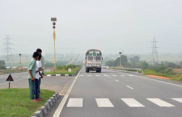
The 339 km Regional Ring Road project beyond Hyderabad's Outer Ring Road is expected to take longer than expected because the centre is said to have ordered a new survey on the volume of traffic on its southern corridor, which spans 181 km.

The resurvey was ordered after the Ministry of Road Transport and Highways (MoRTH) expressed concerns about the project's viability due to traffic volumes of less than 5,000 to 6,000 vehicles per hour on the southern corridor.

The question was whether such a large-scale project could be grounded for such a small number of vehicles.

The state government told the federal government that only after the north and south corridors were linked in a ring would a clear picture of traffic emerge. Only when the road is aligned in a ring will it be useful.

After that, traffic on the southern corridor would be similar to that on the northern one. The prestigious four-lane expressway project, which is expected to cost Rs 7,512 crore, is split into two sections: northern and southern corridors.

After two surveys, the Ministry has approved the final alignment for the northern corridor, which connects Sangareddy, Narsapur, Toopran, Gajwel, Jagdevpur, Bhongir, Yadadri, and Chouttuppal, and has posted it to the State government for land acquisition. This corridor's traffic was set at 19,000 vehicles per hour.

J and J Constructions, based in Nagpur, had submitted four alignment options, one of which was chosen by the Ministry-authorized National Highways Authority of India (NHAI).

In four districts, approximately 4,000 acres of land are required.

Sangareddy, Medak, Siddipet, and Bhongir will each have a 40 km stretch of road that will pass through 80 to 100 villages. Officers and staff from district-level units are expected to complete the land acquisition in one year. By the end of January, the units will take shape.

The project's alignment did not account for balancing reservoirs of the Kaleshwaram lift-irrigation scheme that might fall on the way, although it was billed as the country's long-awaited regional ring road.

As a result, the northern corridor's initial alignment was scrapped in favour of new proposals that took into account reservoirs, canals, and feeder channels.

Several diversions were taken into account when the alignment was redesigned. The NHAI approved of this.

The cost of land acquisition will be split evenly between the state and federal governments, but the road will be built entirely by the federal government under the Bharat Mala programme.

Image Source

The 339 km Regional Ring Road project beyond Hyderabad's Outer Ring Road is expected to take longer than expected because the centre is said to have ordered a new survey on the volume of traffic on its southern corridor, which spans 181 km. The resurvey was ordered after the Ministry of Road Transport and Highways (MoRTH) expressed concerns about the project's viability due to traffic volumes of less than 5,000 to 6,000 vehicles per hour on the southern corridor. The question was whether such a large-scale project could be grounded for such a small number of vehicles. The state government told the federal government that only after the north and south corridors were linked in a ring would a clear picture of traffic emerge. Only when the road is aligned in a ring will it be useful. After that, traffic on the southern corridor would be similar to that on the northern one. The prestigious four-lane expressway project, which is expected to cost Rs 7,512 crore, is split into two sections: northern and southern corridors. After two surveys, the Ministry has approved the final alignment for the northern corridor, which connects Sangareddy, Narsapur, Toopran, Gajwel, Jagdevpur, Bhongir, Yadadri, and Chouttuppal, and has posted it to the State government for land acquisition. This corridor's traffic was set at 19,000 vehicles per hour. J and J Constructions, based in Nagpur, had submitted four alignment options, one of which was chosen by the Ministry-authorized National Highways Authority of India (NHAI). In four districts, approximately 4,000 acres of land are required. Sangareddy, Medak, Siddipet, and Bhongir will each have a 40 km stretch of road that will pass through 80 to 100 villages. Officers and staff from district-level units are expected to complete the land acquisition in one year. By the end of January, the units will take shape. The project's alignment did not account for balancing reservoirs of the Kaleshwaram lift-irrigation scheme that might fall on the way, although it was billed as the country's long-awaited regional ring road. As a result, the northern corridor's initial alignment was scrapped in favour of new proposals that took into account reservoirs, canals, and feeder channels. Several diversions were taken into account when the alignment was redesigned. The NHAI approved of this. The cost of land acquisition will be split evenly between the state and federal governments, but the road will be built entirely by the federal government under the Bharat Mala programme. Image Source

Next Story
Resources

Skyview by Empyrean is Making Benchmarks in the Indian Ropeway Industry

FIL Industries Private Limited, the parent company of Empyrean Skyview Projects that pioneered ropeway mobility solutions in India with Jammu’s Skyview Gondola, is currently developing the Dehradun-Mussoorie ropeway and is on track to complete Phase I by September 2026. The ropeway is set to be India’s longest passenger aerial monocable covering 5.8 km between the foothills of Dehradun in Purkulgam and MDDA taxi stand in the hills of Mussoorie in just under 20 minutes. The firm pioneered green mobility solutions in India with the development of the flagship Skyview Gondola in Jam..

Next Story
Technology

Creativity is for Humans, Productivity is for Robots!

On most construction sites, the rhythm of progress is measured by the clang of steel, the hum of machinery and the sweat of thousands. But increasingly, new sounds are entering the mix: the quiet efficiency of algorithms, the hum of drones overhead, and the precision of robotic arms at work. Behind the concrete and cables, an invisible force is taking hold: data. It is turning blueprints into living simulations, managing fleets of machines, and helping engineers make decisions before a single brick is laid. This is not the construction of tomorrow; it is the architecture of today – built on ..

Next Story
Infrastructure Urban

Bhartiya Urban Unveils ‘Bhartiya Converge’ GCC Enablement Platform

Bhartiya Urban has launched Bhartiya Converge, its latest business venture designed to become India’s premier platform for enabling Global Capability Centres (GCCs). The initiative offers an integrated ecosystem aimed at helping global clients gain a competitive edge in today’s rapidly evolving business environment. Focused on enhancing turnaround time and operational efficiencies, the company seeks to deliver better business outcomes powered by top-tier talent. Bhartiya Converge presents a customised and integrated suite of microservices that addresses the nuanced and evolving operational..

Advertisement

Advertisement

Subscribe to Our Newsletter

Get daily newsletters around different themes from Construction world.

STAY CONNECTED

Advertisement

Advertisement

Advertisement

Advertisement

Talk to us?