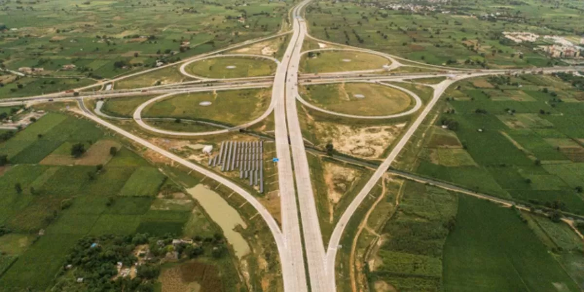
Centre to Map Land along National Highways for Upcoming Projects
ROADS & HIGHWAYS

Centre to Map Land along National Highways for Upcoming Projects

The Ministry of Road Transport and Highways is set to launch a comprehensive initiative to identify unutilised land parcels both within and outside the right of way (RoW) along national highways, according to officials.

RoW refers to a set of property rights granted to government agencies, allowing them to construct and maintain road projects. The nationwide mapping effort will assist these agencies in compiling a consolidated record of land for government use.

An official involved in the program stated that for this land data asset management initiative, the ministry will establish a dedicated unit and assemble a team of land and GIS experts. This team will assist regional offices across various states in gathering plot-wise information. The official also mentioned that the exercise will include reviewing available government documents and conducting on-the-ground visits to towns or villages.

The ministry already operates a land acquisition portal, Bhoomi Rashi, which serves as a centralised platform for processing land notifications and streamlining the land acquisition process, including information on land records within and outside the RoW. Officials noted that the details gathered through the mapping process will eventually facilitate the identification of unutilized land parcels through the portal.

A dedicated unit will be established to review and provide recommendations for improving the online platform used to compile digitised land records and create a centralized land repository. The official added that this initiative will also lay the foundation for future upgrades to the portal. Currently, the total length of national highways, including expressways, is approximately 1.40 lakh kilometre.

The ministry plans to conduct workshops for officials, in coordination with the land acquisition division, to explain the methodologies and processes for digitising revenue maps and collecting and collating data. To ensure the effectiveness of the initiative, the progress will be monitored on a weekly basis.

The Ministry of Road Transport and Highways is set to launch a comprehensive initiative to identify unutilised land parcels both within and outside the right of way (RoW) along national highways, according to officials. RoW refers to a set of property rights granted to government agencies, allowing them to construct and maintain road projects. The nationwide mapping effort will assist these agencies in compiling a consolidated record of land for government use. An official involved in the program stated that for this land data asset management initiative, the ministry will establish a dedicated unit and assemble a team of land and GIS experts. This team will assist regional offices across various states in gathering plot-wise information. The official also mentioned that the exercise will include reviewing available government documents and conducting on-the-ground visits to towns or villages. The ministry already operates a land acquisition portal, Bhoomi Rashi, which serves as a centralised platform for processing land notifications and streamlining the land acquisition process, including information on land records within and outside the RoW. Officials noted that the details gathered through the mapping process will eventually facilitate the identification of unutilized land parcels through the portal. A dedicated unit will be established to review and provide recommendations for improving the online platform used to compile digitised land records and create a centralized land repository. The official added that this initiative will also lay the foundation for future upgrades to the portal. Currently, the total length of national highways, including expressways, is approximately 1.40 lakh kilometre. The ministry plans to conduct workshops for officials, in coordination with the land acquisition division, to explain the methodologies and processes for digitising revenue maps and collecting and collating data. To ensure the effectiveness of the initiative, the progress will be monitored on a weekly basis.

Next Story
Technology

Building Faster, Smarter, and Greener!

Backed by ULCCS’s century-old legacy, U-Sphere combines technology, modular design and sustainable practices to deliver faster and more efficient projects. In an interaction with CW, Rohit Prabhakar, Director - Business Development, shares how the company’s integrated model of ‘Speed-Build’, ‘Smart-Build’ and ‘Sustain-Build’ is redefining construction efficiency, quality and environmental responsibility in India.U-Sphere positions itself at the intersection of speed, sustainability and smart design. How does this translate into measurable efficiency on the ground?At U..

Next Story
Infrastructure Transport

Smart Roads, Smarter India

India’s infrastructure boom is not only about laying more kilometres of highways – it’s about building them smarter, safer and more sustainably. From drones mapping fragile Himalayan slopes to 3D machine-controlled graders reducing human error, technology is steadily reshaping the way projects are planned and executed. Yet, the journey towards digitisation remains complex, demanding not just capital but also coordination, training and vision.Until recently, engineers largely depended on Survey of India toposheets and traditional survey methods like total stations or DGPS to prepare detai..

Next Story
Real Estate

What Does DCPR 2034 Mean?

The Maharashtra government has eased approval norms for high-rise buildings under DCPR 2034, enabling the municipal commissioner to sanction projects up to 180 m on large plots. This change is expected to streamline approvals, reduce procedural delays and accelerate redevelopment, drawing reactions from developers, planners and industry experts about its implications for Mumbai’s vertical growth.Under the revised DCPR 2034 rules, buildings on plots of 2,000 sq m or more can now be approved up to 180 m by the municipal commissioner, provided structural and geotechnical reports are certified b..

Advertisement

Subscribe to Our Newsletter

Get daily newsletters around different themes from Construction world.

STAY CONNECTED

Advertisement

Advertisement

Advertisement

Talk to us?