Delhi-Agra national highway to have Vehicle Actuated Speed Display
ROADS & HIGHWAYS

Delhi-Agra national highway to have Vehicle Actuated Speed Display
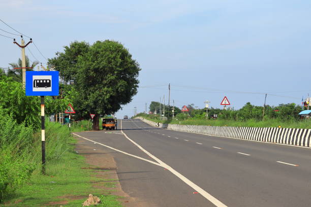
The Delhi-Agra national highway will be India’s first national highway corridor to have screens that would warn commuters if they drive beyond the allowed speed limit.

The Vehicle Actuated Speed Display (VASD) will be established at different locations that would capture and present the vehicle speed in real-time.

It is part of the first significant move by the National Highways Authority of India (NHAI) to set in place the first Advanced Traffic Management System (ATMS) on any NH, which intends to make the corridor smooth and safe for traffic movement. The authority has floated a tender inviting bids from potential players.

The project extent will be from the start point of 4.4 km long six lane Badarpur Elevated Highway to Agra.

The ATMS software will also be able to create an e-challan automatically and integrate with the Vahan database, NIC and FASTag for getting the vehicle registration and details needed for e-challan and cross-verification of the vehicle class.

As per the proposal document, the stretch will get equipment and sensors that will accumulate information on road and traffic conditions, violations, incidents and weather conditions. The information maintained in the system will get transferred to the traffic management centre for processing and action.

The system essentially operates with feed from CCTVs and will alert incidents to the police and emergency service providers for quick rescue at the site. The 180 km stretch will get at least 285 cameras to allow seamless real-time monitoring of road, traffic and weather conditions and traffic. These will be utilised for observing junctions, structures, urban areas, accident-prone areas, major median openings and major village junctions.

Authorities in the NHAI said another component of the video incident detection system (VIDS) at 60 areas would automatically identify abnormal conditions, incidents, accidents, wrong direction driving, stopped vehicles, poor visibility and also vehicle details. These will be set up at black spots, accident-prone and other essential locations identified by the enforcement agencies.

The information of incidents will be automatically put in the system for quick action. Likewise, the vehicle speed detection system (VSDS) with automatic traffic counter and classifier and the travel time measurement system established at two areas will identify the speeding vehicles and read their number plates automatically, and additionally to pass on the information of defaulters and errant drivers to the officials concerned for enforcement and e-challan.

Officials told the media that this stretch has been chosen for the first such project as it is one of the busiest national highways in the nation and links a significant tourist destination. The extent will also receive at least 22 variable message sign display facilities to alert commuters about road and traffic conditions. In case of incidents such as congestion, the displayed information will assist drivers in deciding whether to take a detour or not, an official told the media.

Image Source

Also read: NDMC integrates CCTVs and smart poles in its command centres

The Delhi-Agra national highway will be India’s first national highway corridor to have screens that would warn commuters if they drive beyond the allowed speed limit. The Vehicle Actuated Speed Display (VASD) will be established at different locations that would capture and present the vehicle speed in real-time. It is part of the first significant move by the National Highways Authority of India (NHAI) to set in place the first Advanced Traffic Management System (ATMS) on any NH, which intends to make the corridor smooth and safe for traffic movement. The authority has floated a tender inviting bids from potential players. The project extent will be from the start point of 4.4 km long six lane Badarpur Elevated Highway to Agra. The ATMS software will also be able to create an e-challan automatically and integrate with the Vahan database, NIC and FASTag for getting the vehicle registration and details needed for e-challan and cross-verification of the vehicle class. As per the proposal document, the stretch will get equipment and sensors that will accumulate information on road and traffic conditions, violations, incidents and weather conditions. The information maintained in the system will get transferred to the traffic management centre for processing and action. The system essentially operates with feed from CCTVs and will alert incidents to the police and emergency service providers for quick rescue at the site. The 180 km stretch will get at least 285 cameras to allow seamless real-time monitoring of road, traffic and weather conditions and traffic. These will be utilised for observing junctions, structures, urban areas, accident-prone areas, major median openings and major village junctions. Authorities in the NHAI said another component of the video incident detection system (VIDS) at 60 areas would automatically identify abnormal conditions, incidents, accidents, wrong direction driving, stopped vehicles, poor visibility and also vehicle details. These will be set up at black spots, accident-prone and other essential locations identified by the enforcement agencies. The information of incidents will be automatically put in the system for quick action. Likewise, the vehicle speed detection system (VSDS) with automatic traffic counter and classifier and the travel time measurement system established at two areas will identify the speeding vehicles and read their number plates automatically, and additionally to pass on the information of defaulters and errant drivers to the officials concerned for enforcement and e-challan. Officials told the media that this stretch has been chosen for the first such project as it is one of the busiest national highways in the nation and links a significant tourist destination. The extent will also receive at least 22 variable message sign display facilities to alert commuters about road and traffic conditions. In case of incidents such as congestion, the displayed information will assist drivers in deciding whether to take a detour or not, an official told the media. Image Source Also read: NDMC integrates CCTVs and smart poles in its command centres

Next Story
Infrastructure Urban

MoHUA Plans New Role for Smart City SPVs

In a significant policy move, the Ministry of Housing and Urban Affairs (MoHUA) has issued an advisory encouraging the continued use and repurposing of Special Purpose Vehicles (SPVs) formed under the Smart Cities Mission (SCM). This marks a step toward sustaining urban transformation by leveraging institutional capabilities and infrastructure developed over the past decade.Initiated in 2015, the Smart Cities Mission introduced a new era of urban planning in India, with each of the 100 selected cities forming SPVs under the Companies Act, 2013. These entities, jointly owned by state government..

Next Story
Infrastructure Urban

ADB Approves $110 Million Loan to Boost Skills in Gujarat

The Asian Development Bank (ADB) has approved a USD 109.97 million (Rs 9.27 billion) results-based loan to support Gujarat’s efforts to become a global industrial hub by developing a future-ready, skilled workforce.The funding will back the Gujarat skills development programme, led by the Department of Labour, Skill Development and Employment in collaboration with Kaushalya: The Skill University (KSU). The initiative aims to equip the workforce with advanced, industry-aligned skills to meet rising employment demand in high-growth sectors.According to ADB, the programme seeks to strengthen in..

Next Story
Infrastructure Urban

SDAL Tests Rudrastra UAV and Bhargavastra Defence System

Solar Defence and Aerospace Limited (SDAL) has successfully completed a key flight test of its indigenous Hybrid VTOL UAV Rudrastra at the Pokharan Firing Range, aligning with Indian Army performance benchmarks for mission adaptability, high endurance, precision engagement, and vertical take-off and landing (VTOL) capability.The trial marks a notable achievement in India’s Aatmanirbhar Bharat initiative, underscoring advancements in home-grown military technology. The Rudrastra UAV demonstrated a mission radius exceeding 50 km with uninterrupted video relay, a total operational range of over..

Advertisement

Advertisement

Subscribe to Our Newsletter

Get daily newsletters around different themes from Construction world.

STAY CONNECTED

Advertisement

Advertisement

Advertisement

Advertisement

Talk to us?