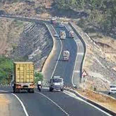
NHIDCL to construct Chhumkhum-Tlabung section in Mizoram

Background
Along with the other north-eastern states, Mizoram is grouped with the nation's weaker economies. There aren't many cottage and small-scale industries in the state. It has few opportunities for heavy industries because it is a remote state with hilly terrain. Other obstacles to industrial development include a lack of labor and raw materials. Agriculture and the service sector continue to contribute the most to state income. While a lot of states in India impinge on the need for continuous development of roads and highways, which invariably contributes to the country’s GDP, there are still parts of the North East that are seeking to make this dream a reality. North Eastern states are still facing connectivity issues that have come in the way of the development of the state and the government. Several villages, including Hrangchalkawn, Theiriat, Sethlun, Luangmual, Lunglei, Hauruang, Pachang, Phairuang, Chhumkhum, Lungsen, Sihphir, Tuichawng, and Tlabung, among others, are traversed by the road.Numerous villages in the vicinity of this road, including Zehtet, Chhuahthum, Chawngte, Benga Veng, Rolui, Phairuangchhuah, Belthei, Diplibagh, and many others in the western part of the villages, heavily rely on it for their social and economic development. The current road has numerous stretches of sharp curves and inclines. It is a single-lane road with a width range of 7.5 to 5.2 meters that does not adhere to any standards or specifications.
As a result, large vehicles and trucks with heavy loads find it challenging to safely navigate these stretches. Due to its central location, this road connects District Town Lunglei with the Indo-Bangladesh Border at River Kawrpui Lui, and it will facilitate one of the main international trade routes between India and Bangladesh, both economically and culturally, but also for Mizoram's western region. It is crucial to upgrade the current Lunglei-Tlabung Road and bring it into compliance with national highway standards.
The Government of India, in view of this, entrusted NHIDCL (National Highway and Infrastructure Development Corporation) with the construction of a 2-lane highway with a hard shoulder configuration from Chummkhum to Tlabung from design chainage km 37.420 to km 74.950 [Pkg-B] for the Lunglei-Tlabung section of NH302 in the state of Mizoram under the Bharatmala Pariyojana on EPC mode. The estimated cost of carrying out this project is 497.95 Cr.
Essential details
Tender Id Number: 2023_NHIDC_744110_1Tender fee: Rs 497.95 Crore
-BID submission start date
12.04.2023
-Last date of Request for BID Document
19.04.2023
-BID Due Date
19.04.2023
Scope of Work
The general scope of work will involve rehabilitating, upgrading, and enhancing the existing carriageway to [two-lane with/without paved shoulders] standards by building new pavement, rehabilitating the upkeep of the project during the Defect Liability Period, and the construction and/or rehabilitation of major and minor bridges, culverts, road intersections, interchanges, drains, etc. as specified in the Schedules. The Contractor shall permit access to and use of the site for the laying of telephone lines, water pipes, electricity lines/cables, or other public utilities, subject to approval from the authority and such conditions as the Authority may specify. The user of the site might be asked to pay compensation or other damages in accordance with applicable laws if such access or use results in any financial loss for the contractor. To avoid any misunderstanding, it is agreed that using the Site in accordance with this Clause 9.3 will not in any way absolve the Contractor of its responsibility to build and maintain the Project Highway in accordance with this Agreement, and any damage brought on by such use will be immediately repaired at the Authority's expense.
ABS Marine Sees CRISIL Credit Rating Upgrade
ABS Marine Services has secured an upgrade to its long term and short term credit ratings from CRISIL, reflecting improved profitability and revenue growth through long term contracts. CRISIL moved the long term rating from BBB+/Stable to A-/Stable and revised the short term rating from A2 to A2+. The action signals strengthened financial metrics and operational resilience. The company benefited from durable client relationships with firms such as ONGC and Schlumberger. The rating decision followed stronger cash flows and an enlarged bank loan facility, which increased from Rs 3,705 million (m..

Project BRAHMANK Marks 16 Years Of Strategic Roads In Arunachal
Project BRAHMANK is marking 16 years of work to establish strategic road and bridge links across Arunachal Pradesh, maintaining and developing 811 kilometres of roads and nearly 86 bridges that range from small culverts to large steel and arch bridges. These transport links are described as critical for ensuring year-round movement of defence personnel, equipment and essential supplies while improving everyday travel for people in remote villages. The project balances national security requirements with regional development by focusing on reliable access in challenging terrain. Notable enginee..
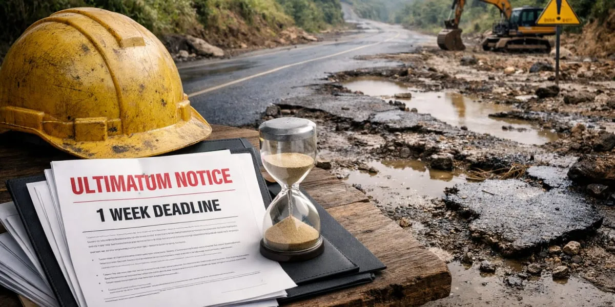
Longleng CSOs Give One Week Ultimatum Over Two-Lane Highway
Civil society organisations (CSOs) in Longleng district have demanded immediate restoration of the deteriorating Changtongya–Longleng two-lane road and sought a detailed status report on the stalled construction within one week. The demand followed a consultative meeting convened under the Phom Peoples' Council (PPC) to discuss welfare and development concerns. PPC president YB Angam Phom said prolonged non-maintenance had caused hardship to commuters and affected transportation, local commerce and the district's development. The meeting urged authorities to undertake immediate restoration a..
Latest Updates