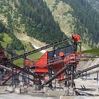





Coal India Signs MoU with NRSC and ISRO
COAL & MINING

Coal India Signs MoU with NRSC and ISRO

Coal India (CIL) has signed a memorandum of understanding with the National Remote Sensing Centre (NRSC) of the Indian Space Research Organisation (ISRO) to develop a specialised geospatial platform. The platform will use high resolution mine block boundary data provided by the Central Mine Planning and Design Institute (CMPDI) to establish automated oversight of operational and environmental areas. The announcement was issued as an official press release dated nine July 2026.

The system will perform real time environmental tracking of mine closure protocols, active land reclamation and the expansion of green cover and afforestation. It will provide digital surveillance to detect and prevent unauthorised mining beyond legal leasehold boundaries to strengthen regulatory compliance. Social infrastructure mapping and verification of rehabilitation and resettlement colonies and project affected areas will also be a core function.

The solution integrates advanced data science tools directly into ISRO's Bhuvan Analytical Dashboard, combining Artificial Intelligence, Machine Learning, Deep Learning and predictive analytics to automate change detection and complex geospatial analysis across active coalfields. CMPDI supplied the high resolution boundary inputs that will feed automated workflows and analytics engines. The platform is designed to produce actionable geospatial intelligence and automated alerts for field teams.

A principal focus of the partnership is the long standing subsurface fires in the Jharia Coalfield in Jharkhand, where predictive modelling on multi spectral satellite data will be used to detect active coal fires and simulate underground fire propagation paths. That capability aims to provide precise geospatial analysis to guide targeted containment measures before fires spread to new coal seams or civil structures. The approach seeks to improve safety and reduce environmental harm in affected districts.

Coal India, NRSC and ISRO expect the initiative to enhance regulatory oversight, environmental restoration and safety planning across active coalfields, while supporting rehabilitation efforts and local agency implementation. The partners will share geospatial outputs with state and field agencies to assist in enforcement and remediation programmes. The collaboration forms part of broader efforts to modernise surveillance and disaster preparedness in the mining sector.

"Join industry leaders at RAHSTA Expo, India's premier platform for roads, highways and traffic infrastructure. Register now to explore innovations, network with experts and shape the future of mobility."

Coal India (CIL) has signed a memorandum of understanding with the National Remote Sensing Centre (NRSC) of the Indian Space Research Organisation (ISRO) to develop a specialised geospatial platform. The platform will use high resolution mine block boundary data provided by the Central Mine Planning and Design Institute (CMPDI) to establish automated oversight of operational and environmental areas. The announcement was issued as an official press release dated nine July 2026. The system will perform real time environmental tracking of mine closure protocols, active land reclamation and the expansion of green cover and afforestation. It will provide digital surveillance to detect and prevent unauthorised mining beyond legal leasehold boundaries to strengthen regulatory compliance. Social infrastructure mapping and verification of rehabilitation and resettlement colonies and project affected areas will also be a core function. The solution integrates advanced data science tools directly into ISRO's Bhuvan Analytical Dashboard, combining Artificial Intelligence, Machine Learning, Deep Learning and predictive analytics to automate change detection and complex geospatial analysis across active coalfields. CMPDI supplied the high resolution boundary inputs that will feed automated workflows and analytics engines. The platform is designed to produce actionable geospatial intelligence and automated alerts for field teams. A principal focus of the partnership is the long standing subsurface fires in the Jharia Coalfield in Jharkhand, where predictive modelling on multi spectral satellite data will be used to detect active coal fires and simulate underground fire propagation paths. That capability aims to provide precise geospatial analysis to guide targeted containment measures before fires spread to new coal seams or civil structures. The approach seeks to improve safety and reduce environmental harm in affected districts. Coal India, NRSC and ISRO expect the initiative to enhance regulatory oversight, environmental restoration and safety planning across active coalfields, while supporting rehabilitation efforts and local agency implementation. The partners will share geospatial outputs with state and field agencies to assist in enforcement and remediation programmes. The collaboration forms part of broader efforts to modernise surveillance and disaster preparedness in the mining sector.

Next Story
Infrastructure Transport

Uttar Pradesh Accelerates National Highway Projects

Uttar Pradesh Chief Minister Yogi Adityanath met Union Road Transport and Highways Minister Nitin Gadkari to review National Highway and road infrastructure projects. Officials from the National Highways Authority of India presented progress updates and proposals. Ministers directed acceleration of land acquisition, forest clearances, utility shifting and other formalities to expedite delivery. Officials said that since 2014 about 10,204 kilometres of National Highway projects have been awarded and nearly 9,329 kilometres completed, with 606 kilometres approved and 1,010 kilometres completed b..

Next Story
Infrastructure Transport

NHAI Completes Repairs at 33 of 40 Spots Along Gurugram NH-48

The National Highways Authority of India has rectified 33 of 40 deficient locations along an 11km stretch of the Delhi–Gurugram NH-48 corridor, following a joint inspection by the authority, the Municipal Corporation of Gurugram and the Gurugram Metropolitan Development Authority. The audit identified damaged footpaths, crash barriers, inadequate lane markings and poor sanitation at multiple points between Rajiv Chowk and Signature Towers. Repairs and maintenance works have been carried out over May and June as part of the exercise. The report noted broken crash barriers and roadside litteri..

Next Story
Infrastructure Urban

Mankhurd Maharashtra Nagar Flyover To Open By August 2027

The Brihanmumbai Municipal Corporation has said the Mankhurd-Maharashtra Nagar flyover will be operational by August 2027, as part of measures to ease congestion in the eastern suburbs. The structure will provide a direct link from the T Junction on the Sion-Panvel highway to the existing Ghatkopar-Mankhurd Link Road. The T Junction is one of the major traffic choke points in the eastern suburbs and records heavy flows of vehicles travelling to and from Navi Mumbai and Pune. Motorists currently spend more than 15 minutes at the signal during peak periods, according to civic data, prompting the..

Advertisement

Subscribe to Our Newsletter

Get daily newsletters around different themes from Construction world.

STAY CONNECTED

Advertisement

Advertisement

Advertisement