IdeaForge's Q6 Mapping Drone Certified
Technology

IdeaForge's Q6 Mapping Drone Certified

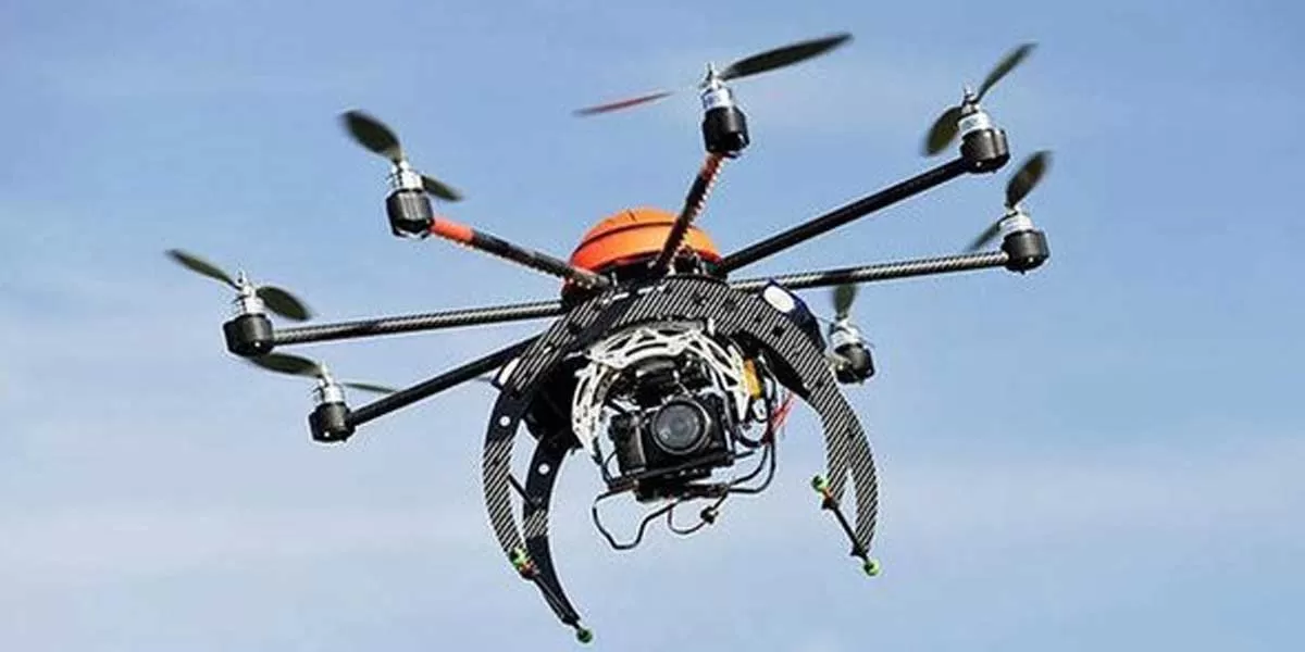
IdeaForge, a pioneer in the realm of unmanned aerial systems, celebrates a significant milestone as its Q6 mapping drone obtains DGCA (Directorate General of Civil Aviation) type certification. This certification solidifies the Q6's status as a reliable and compliant solution for aerial mapping and surveying applications.

Equipped with cutting-edge technology, the Q6 mapping drone boasts exceptional performance capabilities, making it a preferred choice for professionals across various industries. With its high-resolution imaging capabilities and precise navigation system, the Q6 empowers users to capture detailed aerial data with unparalleled accuracy and efficiency.

Engineered for versatility, the Q6 is suitable for a wide range of applications, including land surveying, infrastructure inspection, agriculture, environmental monitoring, and disaster management. Its ability to adapt to diverse environments and deliver superior results makes it an indispensable asset for businesses and organizations seeking advanced aerial solutions.

The DGCA type certification further underscores IdeaForge's commitment to quality, safety, and regulatory compliance. By adhering to stringent aviation standards, IdeaForge ensures that its drones meet the highest levels of reliability and performance, instilling confidence in users and stakeholders alike.

Beyond its technical prowess, the Q6 mapping drone offers user-friendly features and intuitive controls, simplifying the aerial data acquisition process. Whether it's capturing detailed terrain models, monitoring crop health, or inspecting critical infrastructure, users can leverage the Q6's capabilities to streamline workflows and make informed decisions.

As industries continue to embrace the transformative potential of drone technology, IdeaForge remains at the forefront, driving innovation and setting new benchmarks in the field of unmanned aerial systems. With the DGCA type certification for the Q6 mapping drone, IdeaForge reaffirms its position as a trusted partner for professionals seeking reliable, high-performance aerial solutions.

IdeaForge, a pioneer in the realm of unmanned aerial systems, celebrates a significant milestone as its Q6 mapping drone obtains DGCA (Directorate General of Civil Aviation) type certification. This certification solidifies the Q6's status as a reliable and compliant solution for aerial mapping and surveying applications. Equipped with cutting-edge technology, the Q6 mapping drone boasts exceptional performance capabilities, making it a preferred choice for professionals across various industries. With its high-resolution imaging capabilities and precise navigation system, the Q6 empowers users to capture detailed aerial data with unparalleled accuracy and efficiency. Engineered for versatility, the Q6 is suitable for a wide range of applications, including land surveying, infrastructure inspection, agriculture, environmental monitoring, and disaster management. Its ability to adapt to diverse environments and deliver superior results makes it an indispensable asset for businesses and organizations seeking advanced aerial solutions. The DGCA type certification further underscores IdeaForge's commitment to quality, safety, and regulatory compliance. By adhering to stringent aviation standards, IdeaForge ensures that its drones meet the highest levels of reliability and performance, instilling confidence in users and stakeholders alike. Beyond its technical prowess, the Q6 mapping drone offers user-friendly features and intuitive controls, simplifying the aerial data acquisition process. Whether it's capturing detailed terrain models, monitoring crop health, or inspecting critical infrastructure, users can leverage the Q6's capabilities to streamline workflows and make informed decisions. As industries continue to embrace the transformative potential of drone technology, IdeaForge remains at the forefront, driving innovation and setting new benchmarks in the field of unmanned aerial systems. With the DGCA type certification for the Q6 mapping drone, IdeaForge reaffirms its position as a trusted partner for professionals seeking reliable, high-performance aerial solutions.

Next Story
Technology

Building Faster, Smarter, and Greener!

Backed by ULCCS’s century-old legacy, U-Sphere combines technology, modular design and sustainable practices to deliver faster and more efficient projects. In an interaction with CW, Rohit Prabhakar, Director - Business Development, shares how the company’s integrated model of ‘Speed-Build’, ‘Smart-Build’ and ‘Sustain-Build’ is redefining construction efficiency, quality and environmental responsibility in India.U-Sphere positions itself at the intersection of speed, sustainability and smart design. How does this translate into measurable efficiency on the ground?At U..

Next Story
Infrastructure Transport

Smart Roads, Smarter India

India’s infrastructure boom is not only about laying more kilometres of highways – it’s about building them smarter, safer and more sustainably. From drones mapping fragile Himalayan slopes to 3D machine-controlled graders reducing human error, technology is steadily reshaping the way projects are planned and executed. Yet, the journey towards digitisation remains complex, demanding not just capital but also coordination, training and vision.Until recently, engineers largely depended on Survey of India toposheets and traditional survey methods like total stations or DGPS to prepare detai..

Next Story
Real Estate

What Does DCPR 2034 Mean?

The Maharashtra government has eased approval norms for high-rise buildings under DCPR 2034, enabling the municipal commissioner to sanction projects up to 180 m on large plots. This change is expected to streamline approvals, reduce procedural delays and accelerate redevelopment, drawing reactions from developers, planners and industry experts about its implications for Mumbai’s vertical growth.Under the revised DCPR 2034 rules, buildings on plots of 2,000 sq m or more can now be approved up to 180 m by the municipal commissioner, provided structural and geotechnical reports are certified b..

Advertisement

Subscribe to Our Newsletter

Get daily newsletters around different themes from Construction world.

STAY CONNECTED

Advertisement

Advertisement

Advertisement

Talk to us?