
+
BIM helps create a digital twin in historic city
SMART CITIES

BIM helps create a digital twin in historic city

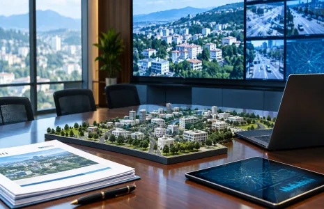
POWERCHINA Huadong Engineering Corporation (HDEC) is using BIM to provide the foundation of a co-called Digital Twin that the company says will transform the ancient Chinese city of Shaoxing.

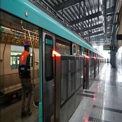
The company is responsible for the digital engineering of Shaoxing’s new Urban Rail Transit Line 1. Construction of the 34.1 km line in the eastern coastal Zhejiang province is planned to finish in June 2021, with railway operations scheduled to commence in 2022. Digital workflows will increase productivity, improve quality, mitigate risk, and lay the foundations of a digital twin of the railway for use in operations and maintenance. The construction of the line commenced in 2017.

The city of Shaoxing carries a history of more than 2,500 years. With the title of Oriental Venice, the 21 sq km city is rich in lakes, rivers, and rainfall. With the new Urban Rail Transit Line 1, the city will be linked with the cities of Hangzhou and it’s Metro Line 5 via the Hangzhou-Shaoxing Intercity Railway. The 34.1 km line is expected to be constructed by June 2021.

HDEC is employing real-time analysis and data from various sources that are processed in a connected data environment to enhance the accuracy and impact of the decisions for the project. Furthermore, the digital approach will directly improve the project's efficiency, quality, and productivity while reducing the risk.

The construction of the Urban Rail Transit Line 1 is the largest infrastructure project in the city. It is mostly underground with 24 stations, 25 sections, one depot, a parking lot, two main substations, and a control center.

HDEC required complex software to meet the requirements and provide a solution to all the problems that can occur during the construction. The issues include limited space, hydrogeological conditions, the safety of the foundation pits due to the thickness of the soft soil, water leakage during construction, and other technical interfaces.

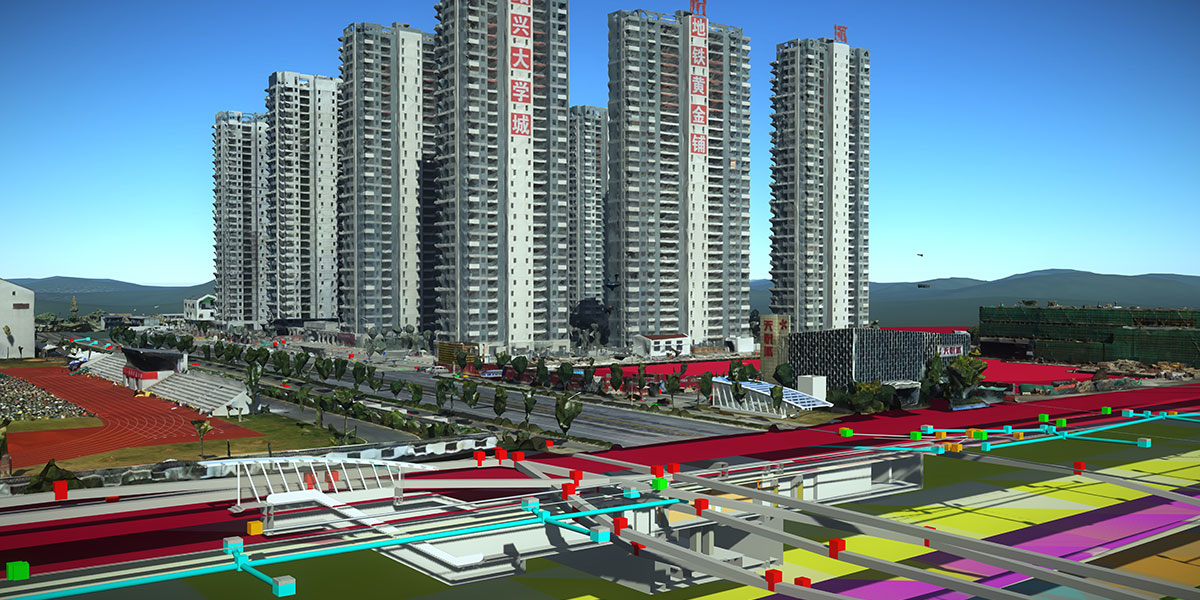
To address the issue of having a limited workspace and testing environmental conditions, HDEC has developed a 3D geology software, GeoStation, based on Bentley’s iTwin technology. The technology is used to create a 3D reality mesh using aerial photographs of the city. The unique approach enabled HDEC to save more than 800 hours of field data collection time while reducing the project's cost by CNY 3 million. With BIM technology and an automated monitoring system, the real-time data of the surroundings can be analysed to tackle any abnormalities.

POWERCHINA Huadong Engineering Corporation (HDEC) is using BIM to provide the foundation of a co-called Digital Twin that the company says will transform the ancient Chinese city of Shaoxing. The company is responsible for the digital engineering of Shaoxing’s new Urban Rail Transit Line 1. Construction of the 34.1 km line in the eastern coastal Zhejiang province is planned to finish in June 2021, with railway operations scheduled to commence in 2022. Digital workflows will increase productivity, improve quality, mitigate risk, and lay the foundations of a digital twin of the railway for use in operations and maintenance. The construction of the line commenced in 2017. The city of Shaoxing carries a history of more than 2,500 years. With the title of Oriental Venice, the 21 sq km city is rich in lakes, rivers, and rainfall. With the new Urban Rail Transit Line 1, the city will be linked with the cities of Hangzhou and it’s Metro Line 5 via the Hangzhou-Shaoxing Intercity Railway. The 34.1 km line is expected to be constructed by June 2021. HDEC is employing real-time analysis and data from various sources that are processed in a connected data environment to enhance the accuracy and impact of the decisions for the project. Furthermore, the digital approach will directly improve the project's efficiency, quality, and productivity while reducing the risk. The construction of the Urban Rail Transit Line 1 is the largest infrastructure project in the city. It is mostly underground with 24 stations, 25 sections, one depot, a parking lot, two main substations, and a control center. HDEC required complex software to meet the requirements and provide a solution to all the problems that can occur during the construction. The issues include limited space, hydrogeological conditions, the safety of the foundation pits due to the thickness of the soft soil, water leakage during construction, and other technical interfaces. To address the issue of having a limited workspace and testing environmental conditions, HDEC has developed a 3D geology software, GeoStation, based on Bentley’s iTwin technology. The technology is used to create a 3D reality mesh using aerial photographs of the city. The unique approach enabled HDEC to save more than 800 hours of field data collection time while reducing the project's cost by CNY 3 million. With BIM technology and an automated monitoring system, the real-time data of the surroundings can be analysed to tackle any abnormalities.

Related Stories

Gold Stories

Next Story
Real Estate

Kamdhenu Realities acquires 4-acre Navi Mumbai land parcel

Kamdhenu Realities has acquired a 4-acre land parcel from RPG Life Sciences on Thane-Belapur Road for approximately Rs 1.5 billion, expanding its commercial real estate portfolio in Navi Mumbai.The parcel has a total developable potential of 1.8 million sq ft, on which Kamdhenu plans to develop a destination-scale commercial and lifestyle ecosystem. The proposed development will combine corporate office suites with high-street retail, F&B outlets, double-height lobbies, business infrastructure and lifestyle amenities.Located close to IKEA and opposite the upcoming Pawane Railway Station, t..

Next Story
Infrastructure Transport

97 Per Cent Of Rongjeng-Mangsang-Adokgre Road Nears Completion

Deputy Chief Minister in-charge of public works Prestone Tynsong said in Shillong on 26 August that 97 per cent physical progress had been achieved on the ongoing Rongjeng-Mangsang-Adokgre road being constructed under the Non-Lapsable Central Pool of Resources (NLCPR). He noted the project was sanctioned in 2017 and that the stipulated time for completion had been 24 months from issue of the final work order. The deputy chief minister informed the assembly that the government had decided to include the remaining work under a World Bank project. In reply to a query from Rongjeng MLA Jim M Sangm..

Next Story
Infrastructure Transport

First TBM Starts Digging Five Point Three Kilometre Tunnel Under SGNP

The Goregaon-Mulund Link Road (GMLR) Phase three (B) project has reached a key milestone as the first tunnel boring machine (TBM) began excavation of the first of two tunnels beneath the Sanjay Gandhi National Park (SGNP). The machine, named Tulsi, started cutting a five point three kilometre bore that will link Dadasaheb Phalke Chitranagari in Goregaon East with Amar Nagar in Mulund West. Officials issued a statement noting the commencement of tunnelling work under the protected green belt. The twin tunnels are being constructed using mechanised tunnelling methods that aim to limit surface di..

Advertisement

Subscribe to Our Newsletter

Get daily newsletters around different themes from Construction world.

STAY CONNECTED

Advertisement

SPECIAL OFFER
QR Code