Aurangabad airport expansion hits bottleneck
AVIATION & AIRPORTS

Aurangabad airport expansion hits bottleneck

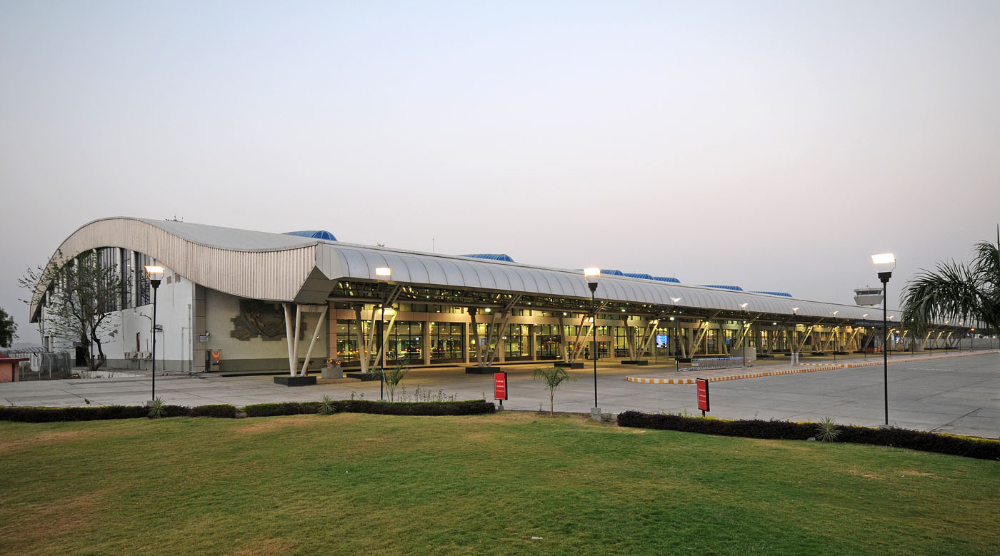
The land records department has initiated the process of land acquisition for the proposed expansion of Aurangabad airport may prove to be a stiff challenge for the authorities.

The Aurangabad airport has now become part of the city due to rapid urbanisation and the acquisition of 182 acre of land needed for the proposed expansion may prove challenging for the authorities.

The proposed expansion involves extending the runway to 12,000 feet from the existing 9,300 feet, facilitating hangar for aircraft, building a parallel taxiway, and installation of solar panels.

Land records department officials Shaikh Arif said that the desired task of land measurement would be expedited as there is no fixed time limit for accomplishing the task.

The Aurangabad airport expansion demand received an official boost when former chief minister Devendra Fadnavis had pledged Rs 200 crore for creating the necessary infrastructure, during a special cabinet meeting on October 4, 2016, held in Aurangabad.

The official surveys carried out in the past had identified certain residential properties from Chikalthana along with the land owned by farmers as well as the City and Industrial Development Corporation of Maharashtra (CIDCO), Aurangabad Municipal Corporation, and Maharashtra Housing & Area Development Authority (MHADA) lands that are likely to come in way of the proposed expansion of Aurangabad airport.

Image Source


Also read: Noida airport: UP cabinet approves proposal to acquire 1,365 hectare land

Also read: UP govt okays ph 2 land acquisition for Noida airport

The land records department has initiated the process of land acquisition for the proposed expansion of Aurangabad airport may prove to be a stiff challenge for the authorities. The Aurangabad airport has now become part of the city due to rapid urbanisation and the acquisition of 182 acre of land needed for the proposed expansion may prove challenging for the authorities. The proposed expansion involves extending the runway to 12,000 feet from the existing 9,300 feet, facilitating hangar for aircraft, building a parallel taxiway, and installation of solar panels. Land records department officials Shaikh Arif said that the desired task of land measurement would be expedited as there is no fixed time limit for accomplishing the task. The Aurangabad airport expansion demand received an official boost when former chief minister Devendra Fadnavis had pledged Rs 200 crore for creating the necessary infrastructure, during a special cabinet meeting on October 4, 2016, held in Aurangabad. The official surveys carried out in the past had identified certain residential properties from Chikalthana along with the land owned by farmers as well as the City and Industrial Development Corporation of Maharashtra (CIDCO), Aurangabad Municipal Corporation, and Maharashtra Housing & Area Development Authority (MHADA) lands that are likely to come in way of the proposed expansion of Aurangabad airport. Image Source Also read: Noida airport: UP cabinet approves proposal to acquire 1,365 hectare land Also read: UP govt okays ph 2 land acquisition for Noida airport

Next Story
Technology

Building Faster, Smarter, and Greener!

Backed by ULCCS’s century-old legacy, U-Sphere combines technology, modular design and sustainable practices to deliver faster and more efficient projects. In an interaction with CW, Rohit Prabhakar, Director - Business Development, shares how the company’s integrated model of ‘Speed-Build’, ‘Smart-Build’ and ‘Sustain-Build’ is redefining construction efficiency, quality and environmental responsibility in India.U-Sphere positions itself at the intersection of speed, sustainability and smart design. How does this translate into measurable efficiency on the ground?At U..

Next Story
Infrastructure Transport

Smart Roads, Smarter India

India’s infrastructure boom is not only about laying more kilometres of highways – it’s about building them smarter, safer and more sustainably. From drones mapping fragile Himalayan slopes to 3D machine-controlled graders reducing human error, technology is steadily reshaping the way projects are planned and executed. Yet, the journey towards digitisation remains complex, demanding not just capital but also coordination, training and vision.Until recently, engineers largely depended on Survey of India toposheets and traditional survey methods like total stations or DGPS to prepare detai..

Next Story
Real Estate

What Does DCPR 2034 Mean?

The Maharashtra government has eased approval norms for high-rise buildings under DCPR 2034, enabling the municipal commissioner to sanction projects up to 180 m on large plots. This change is expected to streamline approvals, reduce procedural delays and accelerate redevelopment, drawing reactions from developers, planners and industry experts about its implications for Mumbai’s vertical growth.Under the revised DCPR 2034 rules, buildings on plots of 2,000 sq m or more can now be approved up to 180 m by the municipal commissioner, provided structural and geotechnical reports are certified b..

Advertisement

Subscribe to Our Newsletter

Get daily newsletters around different themes from Construction world.

STAY CONNECTED

Advertisement

Advertisement

Advertisement

Talk to us?