+
AMC Approves Citywide GIS Mapping And Digital Door IDs
ECONOMY & POLICY

AMC Approves Citywide GIS Mapping And Digital Door IDs

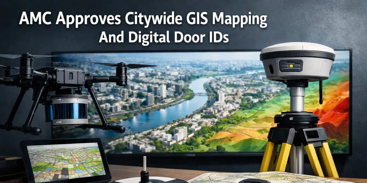
The Amdavad Municipal Corporation has approved a citywide Geographic Information System to consolidate property, road, land use and utility data for planning and services. The project will update the 2014 GIS to reflect expansion and upgraded infrastructure. Aerial LiDAR and photography will cover the 625 sq km municipal area and a DGPS survey will establish 240 ground control points, including 40 primary and 200 secondary points. The data will support 30 centimetre Digital Terrain Models (DTM), Digital Surface Models (DSM) and a 1:500 scale base map.

Around 5,200 km of roads will be surveyed with Mobile LiDAR and 360 degree imaging; underground utilities of about 5,200 km, including water pipelines and sewer lines, will be recorded for asset management. The programme will geo code about two point five million (mn) properties through door to door surveys and assign a Digital Door ID to aid property tax assessment and verification. True orthophotos and ortho mosaic imagery will be produced with five centimetre accuracy.

The AMC will develop a three dimensional digital twin of the city with Level of Detail three models for 500 key buildings. 12 GIS based applications will support town planning, disaster management, health services and a citizen geoportal and will be integrated with property tax systems, the Centralised Complaint Redressal System and SCADA. The estate department's property registers and related financial, legal and possession documents will be digitised.

During the five year operation and maintenance period the GIS database will be updated using drone and satellite imagery and machine learning based change detection applied to annual satellite data. The AMC expects the platform to enable faster, better informed decisions on road development, utility planning and disaster management and to improve transparency in civic administration. The system aims to support more efficient service delivery and easier verification of records.

The Amdavad Municipal Corporation has approved a citywide Geographic Information System to consolidate property, road, land use and utility data for planning and services. The project will update the 2014 GIS to reflect expansion and upgraded infrastructure. Aerial LiDAR and photography will cover the 625 sq km municipal area and a DGPS survey will establish 240 ground control points, including 40 primary and 200 secondary points. The data will support 30 centimetre Digital Terrain Models (DTM), Digital Surface Models (DSM) and a 1:500 scale base map. Around 5,200 km of roads will be surveyed with Mobile LiDAR and 360 degree imaging; underground utilities of about 5,200 km, including water pipelines and sewer lines, will be recorded for asset management. The programme will geo code about two point five million (mn) properties through door to door surveys and assign a Digital Door ID to aid property tax assessment and verification. True orthophotos and ortho mosaic imagery will be produced with five centimetre accuracy. The AMC will develop a three dimensional digital twin of the city with Level of Detail three models for 500 key buildings. 12 GIS based applications will support town planning, disaster management, health services and a citizen geoportal and will be integrated with property tax systems, the Centralised Complaint Redressal System and SCADA. The estate department's property registers and related financial, legal and possession documents will be digitised. During the five year operation and maintenance period the GIS database will be updated using drone and satellite imagery and machine learning based change detection applied to annual satellite data. The AMC expects the platform to enable faster, better informed decisions on road development, utility planning and disaster management and to improve transparency in civic administration. The system aims to support more efficient service delivery and easier verification of records.

Related Stories

Gold Stories

Next Story
Infrastructure Transport

MMRDA Targets Completion of Projects by December 2028

The Mumbai Metropolitan Region Development Authority (MMRDA) is targeting the completion of all its ongoing infrastructure projects by December 2028, a year ahead of its December 2029 deadline, Metropolitan Commissioner Dr Sanjay Mukherjee has said.Speaking at the sixth edition of the Real Estate & Infrastructure Investors' Summit (REIIS) 2026 in Mumbai, Mukherjee said the authority was developing an integrated network of roads, tunnels, sea links and Metro corridors under its broader vision of “Mumbai in 59 Minutes”.The objective is to improve east-west and north-south connectivity an..

Next Story
Building Material

High-Performance Façades Gain Ground in Indian Buildings

High-performance façades are gaining greater importance in Indian architecture as developers and architects increasingly focus on energy efficiency, thermal comfort and building performance, according to Shankar Fenestrations & Glasses.The company said modern façade systems are increasingly being considered as part of a building's overall performance strategy rather than being used primarily as aesthetic elements.High-performance glass, curtain wall systems and structural glazing can contribute to thermal regulation, solar control, daylight management and indoor comfort. Their growing ad..

Next Story
Technology

SPML Infra's 104.4 kWh BESS Battery Pack Clears Global Tests

SPML Infra has announced that its proprietary 104.4 kWh Battery Energy Storage System (BESS) battery pack has completed key international safety, performance and transportation testing and certification requirements, marking a step towards its commercial deployment.Developed under the company's own intellectual property, the battery pack has completed requirements under UL9540A, IEC 62619, IEC 63056, IEC 60730, IEC 61000-6-2, IEC 61000-6-4 and UN38.3 standards.The testing covers areas including thermal runaway safety, battery performance, system functional safety, electromagnetic compatibility..

Advertisement

Subscribe to Our Newsletter

Get daily newsletters around different themes from Construction world.

STAY CONNECTED

Advertisement

SPECIAL OFFER
QR Code